


j03

lm178
User
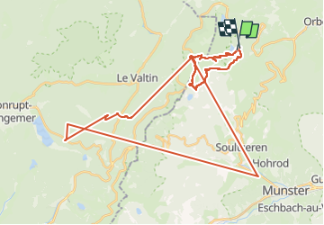

Length
43 km

Max alt
1300 m

Uphill gradient
3158 m
Km-Effort
85 km

Min alt
420 m

Downhill gradient
3139 m
Boucle
Yes
Creation date :
2022-10-05 07:24:07.019
Updated on :
2022-10-05 15:05:50.553
4h37
Difficulty : Very easy

FREE GPS app for hiking
 SityTrail
IGN / Geographical institutes
SityTrail Plus
The world is yours!
About
Trail Walking of 43 km to be discovered at Grand Est, Haut-Rhin, Orbey. This trail is proposed by lm178.
Positioning
Country:
France
Region :
Grand Est
Department/Province :
Haut-Rhin
Municipality :
Orbey
Location:
Unknown
Start:(Dec)
Start:(UTM)
358582 ; 5330554 (32U) N.
Comments