


col de Rocheplane

Liebeaux
User
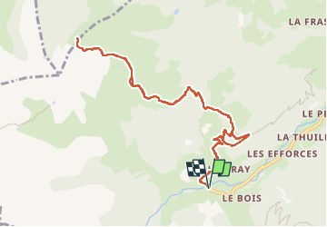

Length
11.9 km

Max alt
2087 m

Uphill gradient
1076 m
Km-Effort
26 km

Min alt
1200 m

Downhill gradient
1076 m
Boucle
Yes
Creation date :
2022-10-06 07:04:50.192
Updated on :
2022-10-06 13:39:01.693
6h33
Difficulty : Very difficult

FREE GPS app for hiking
 SityTrail
IGN / Geographical institutes
SityTrail Plus
The world is yours!
About
Trail Walking of 11.9 km to be discovered at Auvergne-Rhône-Alpes, Savoy, Beaufort. This trail is proposed by Liebeaux.
Positioning
Country:
France
Region :
Auvergne-Rhône-Alpes
Department/Province :
Savoy
Municipality :
Beaufort
Location:
Unknown
Start:(Dec)
Start:(UTM)
308419 ; 5060581 (32T) N.
Comments