


Lachtelweiler

Danielj
User
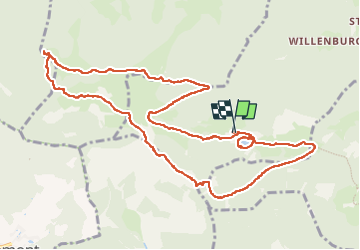

Length
12.3 km

Max alt
1070 m

Uphill gradient
490 m
Km-Effort
18.9 km

Min alt
734 m

Downhill gradient
492 m
Boucle
Yes
Creation date :
2022-10-11 07:34:47.0
Updated on :
2022-10-11 14:59:52.937
4h36
Difficulty : Difficult

FREE GPS app for hiking
 SityTrail
IGN / Geographical institutes
SityTrail Plus
The world is yours!
About
Trail Walking of 12.3 km to be discovered at Grand Est, Haut-Rhin, Kirchberg. This trail is proposed by Danielj.
Positioning
Country:
France
Region :
Grand Est
Department/Province :
Haut-Rhin
Municipality :
Kirchberg
Location:
Unknown
Start:(Dec)
Start:(UTM)
344812 ; 5293765 (32T) N.
Comments