


Laroque les Albères / Fond de la Vallauria/Laroque des Albères

marcheur75
User
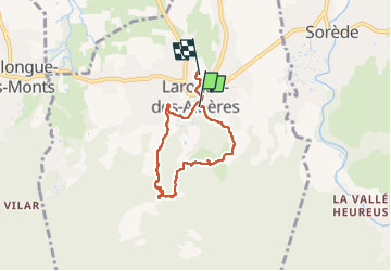

Length
5.7 km

Max alt
258 m

Uphill gradient
167 m
Km-Effort
8 km

Min alt
85 m

Downhill gradient
188 m
Boucle
No
Creation date :
2022-10-12 09:17:18.797
Updated on :
2022-10-12 11:17:15.25
1h43
Difficulty : Medium

FREE GPS app for hiking
 SityTrail
IGN / Geographical institutes
SityTrail Plus
The world is yours!
About
Trail Walking of 5.7 km to be discovered at Occitania, Pyrénées-Orientales, Laroque-des-Albères. This trail is proposed by marcheur75.
Description
balade en boucle vers le Font de la vallauria les cascades et retour Laroque-des-Albères
Positioning
Country:
France
Region :
Occitania
Department/Province :
Pyrénées-Orientales
Municipality :
Laroque-des-Albères
Location:
Unknown
Start:(Dec)
Start:(UTM)
494692 ; 4707696 (31T) N.
Comments