


CHA - J5 - 14/09 - Attignat Oncin > La Serraz - R

aeldin
User
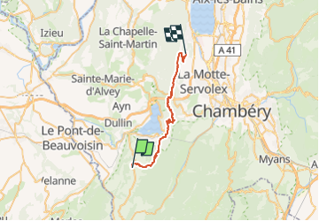

Length
26 km

Max alt
1034 m

Uphill gradient
1114 m
Km-Effort
41 km

Min alt
336 m

Downhill gradient
1315 m
Boucle
No
Creation date :
2022-10-13 11:23:27.836
Updated on :
2022-10-13 12:47:31.945
20m
Difficulty : Easy

FREE GPS app for hiking
 SityTrail
IGN / Geographical institutes
SityTrail Plus
The world is yours!
About
Trail Horseback riding of 26 km to be discovered at Auvergne-Rhône-Alpes, Savoy, Attignat-Oncin. This trail is proposed by aeldin.

Positioning
Country:
France
Region :
Auvergne-Rhône-Alpes
Department/Province :
Savoy
Municipality :
Attignat-Oncin
Location:
Unknown
Start:(Dec)
Start:(UTM)
716072 ; 5042737 (31T) N.
Comments