


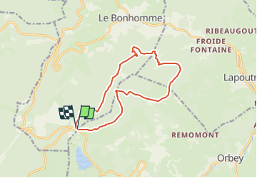
Autour de la Tête des Faux depuis le Col du Calvaire via l'Étang du Devin

daniel_2w
User

Length
12.7 km

Max alt
1159 m

Uphill gradient
339 m
Km-Effort
17.2 km

Min alt
933 m

Downhill gradient
341 m
Boucle
Yes
Creation date :
2022-10-13 18:13:02.838
Updated on :
2022-10-13 18:13:02.838
--
Difficulty : Unknown

FREE GPS app for hiking
 SityTrail
IGN / Geographical institutes
SityTrail Plus
The world is yours!
About
Trail Nordic walking of 12.7 km to be discovered at Grand Est, Haut-Rhin, Le Bonhomme. This trail is proposed by daniel_2w.
Points of interest


Positioning
Country:
France
Region :
Grand Est
Department/Province :
Haut-Rhin
Municipality :
Le Bonhomme
Location:
Unknown
Start:(Dec)
Start:(UTM)
357803 ; 5333280 (32U) N.
Comments