


Circuit des quatre lacs dans les Vosges

daniel_2w
User
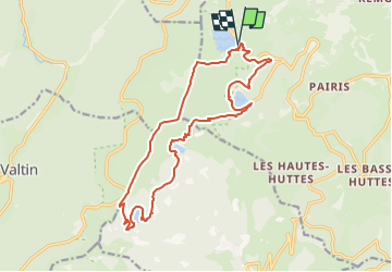

Length
16.8 km

Max alt
1304 m

Uphill gradient
865 m
Km-Effort
28 km

Min alt
953 m

Downhill gradient
856 m
Boucle
Yes
Creation date :
2022-10-13 18:14:51.838
Updated on :
2022-10-13 18:14:51.838
--
Difficulty : Unknown

FREE GPS app for hiking
 SityTrail
IGN / Geographical institutes
SityTrail Plus
The world is yours!
About
Trail Nordic walking of 16.8 km to be discovered at Grand Est, Haut-Rhin, Orbey. This trail is proposed by daniel_2w.
Points of interest


Positioning
Country:
France
Region :
Grand Est
Department/Province :
Haut-Rhin
Municipality :
Orbey
Location:
Unknown
Start:(Dec)
Start:(UTM)
358325 ; 5331981 (32U) N.
Comments