


Le Fein GNF

jmgeffrin
User
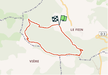

Length
8 km

Max alt
1551 m

Uphill gradient
427 m
Km-Effort
13.7 km

Min alt
1119 m

Downhill gradient
426 m
Boucle
Yes
Creation date :
2022-10-14 07:45:10.598
Updated on :
2022-10-14 20:52:55.791
3h22
Difficulty : Difficult

FREE GPS app for hiking
 SityTrail
IGN / Geographical institutes
SityTrail Plus
The world is yours!
About
Trail Walking of 8 km to be discovered at Provence-Alpes-Côte d'Azur, Hautes-Alpes, Chorges. This trail is proposed by jmgeffrin.
Positioning
Country:
France
Region :
Provence-Alpes-Côte d'Azur
Department/Province :
Hautes-Alpes
Municipality :
Chorges
Location:
Unknown
Start:(Dec)
Start:(UTM)
282316 ; 4933039 (32T) N.
Comments