


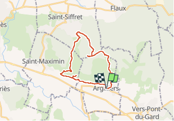

6.8 km | 8.6 km-effort

User


FREE GPS app for hiking
 SityTrail
IGN / Geographical institutes
SityTrail World
The world is yours!
Trail Walking of 13.6 km to be discovered at Occitania, Gard, Argilliers. This trail is proposed by Manoune.
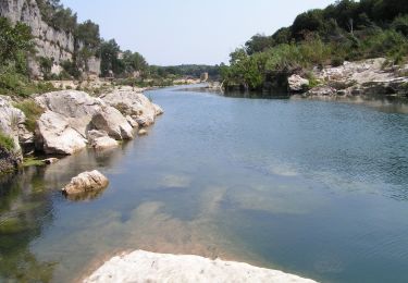
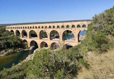
Parking de l'église. Suivre la petite route, puis la piste vers Bordnègre, aller-retour à l'aqueduc mais ne pas prendre le chemin marqué passage interdit, Revenir sur la piste jusqu'à Les Bérringuières. Prendre à droite le chemin direction la Combe de Picouvert montant vers une grande piste. Aller retour sur la droite vers les gouffres et suivre la piste passant sous le stade en direction des Darbounelles. Passage dans le petit lotissement et rejoindre à droite la grande piste vers Brugas et Vallongue. Suivre l'indication du Bal des Lapins puis orendre le petit sentier dans le bois jusqu'à l'entrée du village. Retour au parking.


Walking

Walking

Running

Walking
Walking
Walking
On foot
Walking

Mountain bike