


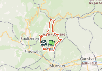
Le Hohrod Glasborn

oscar1
User

Length
11.2 km

Max alt
987 m

Uphill gradient
518 m
Km-Effort
18.1 km

Min alt
467 m

Downhill gradient
520 m
Boucle
Yes
Creation date :
2022-10-16 08:13:25.795
Updated on :
2022-10-17 19:41:32.47
3h19
Difficulty : Medium

FREE GPS app for hiking
 SityTrail
IGN / Geographical institutes
SityTrail Plus
The world is yours!
About
Trail Walking of 11.2 km to be discovered at Grand Est, Haut-Rhin, Hohrod. This trail is proposed by oscar1.
Description
Très beau points de vues
Photos


Positioning
Country:
France
Region :
Grand Est
Department/Province :
Haut-Rhin
Municipality :
Hohrod
Location:
Unknown
Start:(Dec)
Start:(UTM)
360298 ; 5324048 (32U) N.
Comments