


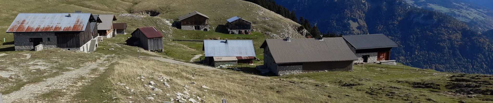
GLIERES: CHALETS DES AUGES

djeepee74
User
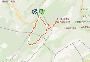

Length
13 km

Max alt
1796 m

Uphill gradient
512 m
Km-Effort
19.8 km

Min alt
1377 m

Downhill gradient
511 m
Boucle
Yes
Creation date :
2022-10-17 07:28:28.362
Updated on :
2022-10-21 13:40:32.941
3h42
Difficulty : Medium

FREE GPS app for hiking
 SityTrail
IGN / Geographical institutes
SityTrail Plus
The world is yours!
About
Trail Walking of 13 km to be discovered at Auvergne-Rhône-Alpes, Upper Savoy, Fillière. This trail is proposed by djeepee74.
Description
BOUCLE... live du 20221017
Photos


Positioning
Country:
France
Region :
Auvergne-Rhône-Alpes
Department/Province :
Upper Savoy
Municipality :
Fillière
Location:
Thorens-Glières
Start:(Dec)
Start:(UTM)
292838 ; 5093424 (32T) N.
Comments