Trail Walking Barrême - 18-10-2022 Pied Marcelin - Château plus haut - Photo

18-10-2022 Pied Marcelin - Château plus haut

 Kargil
Kargil

User GUIDE

© OpenStreetMap contributors
Length
Length
15.7 km
Max alt
Max alt
1225 m
Uphill gradient
Uphill gradient
615 m
Km-Effort
Km-Effort  
24 km
Min alt
Min alt
723 m
Downhill gradient
Downhill gradient
618 m
Boucle
Boucle
Yes
Creation date :
2022-10-18 07:21:55.402
Updated on :
2022-10-18 18:19:58.546

(0 Reviews)

Walking
Walking
4h27
Difficulty : Medium

Scan this QR Code to open this trail in the SityTrail application

FREE GPS app for hiking

Logo SityTrail SityTrail

IGN / Geographical institutes

Download SityTrail from the App Store Download SityTrail from Google Play

Logo SityTrail SityTrail World

The world is yours!

Download SityTrail from the App Store Download SityTrail from Google Play Download SityTrail on Huawei AppGallery

About

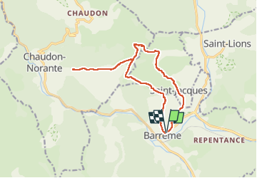
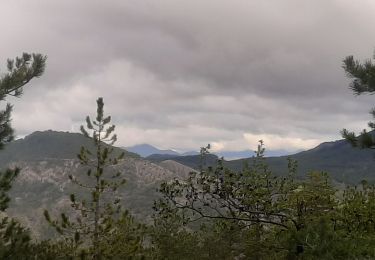
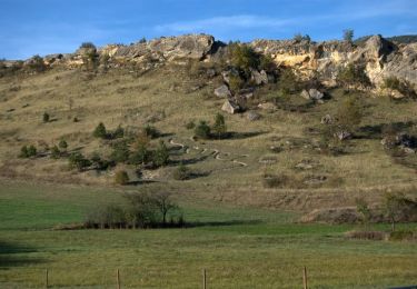
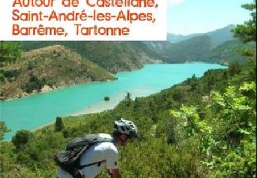
Trail Walking of 15.7 km to be discovered at Provence-Alpes-Côte d'Azur, Alpes-de-Haute-Provence, Barrême. This trail is proposed by Kargil.

Description

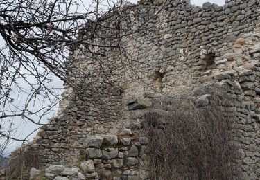
Dernière descente avant Saint Jacques à aborder avec attention.
Pas de difficultés techniques

Elevation profile

Photos

Positioning

Country:
France
Region :
Provence-Alpes-Côte d'Azur
Department/Province :
Alpes-de-Haute-Provence
Municipality :
Barrême
Location:
Unknown
Start:(UTM)
289016 ; 4870140 (32T) N.

Trails nearby

Trail Walking Senez - La Voie Impériale (Etape 2 : Senez - Chaudon-Norante (La Clappe)) - Photo
Walking
tracegps

Walking

Difficult
(1)
Senez, Provence-Alpes-Côte d'Azur, Alpes-de-Haute-Provence, France
19.5 km | 30 km-effort
6h 0min
No
Trail Walking Senez - SENEZ , clue de la Melle. , chapelle  de la Melle ,  o s - Photo
Walking
RobinMicheline

Walking

Easy
Senez, Provence-Alpes-Côte d'Azur, Alpes-de-Haute-Provence, France
17.2 km | 24 km-effort
4h 28min
Yes
Trail Walking Saint-Jacques - SAINT JACQUES.  PRE DE SIROM .  ENTRE PUY , PIED MARCELLIN . Chateau plus haut , Chaudon , col de Chaudon ,  - Photo
Walking
RobinMicheline

Walking

Difficult
Saint-Jacques, Provence-Alpes-Côte d'Azur, Alpes-de-Haute-Provence, France
16.5 km | 25 km-effort
4h 52min
Yes
Trail Mountain bike Barrême - Espace VTT - FFC du Verdon et des Vallées de l'Asse - Le Tour de Lieye n°15 -  Barrême - Photo
Mountain bike
tracegps

Mountain bike

Difficult
Barrême, Provence-Alpes-Côte d'Azur, Alpes-de-Haute-Provence, France
19 km | 28 km-effort
2h 30min
Yes
Trail Equestrian Senez - La Voie Impériale (Etape 2 : Senez - Chaudon-Norante (La Clappe)) - Photo
Equestrian
tracegps

Equestrian

Difficult
Senez, Provence-Alpes-Côte d'Azur, Alpes-de-Haute-Provence, France
19.5 km | 30 km-effort
5h 0min
No
Trail Walking Barrême - barrême  chateau  plus haut  chaudon 19.5km 860m - Photo
Walking
Danielba

Walking

Easy
Barrême, Provence-Alpes-Côte d'Azur, Alpes-de-Haute-Provence, France
18.9 km | 30 km-effort
7h 11min
Yes
Trail Walking Barrême - Barème-château plus haut-St Jacques  - Photo
Walking
RayFab

Walking

Medium
Barrême, Provence-Alpes-Côte d'Azur, Alpes-de-Haute-Provence, France
17.7 km | 26 km-effort
6h 14min
Yes
Trail On foot Chaudon-Norante - Château plus Haut - Photo
On foot
PRO

On foot

Easy
Chaudon-Norante, Provence-Alpes-Côte d'Azur, Alpes-de-Haute-Provence, France
9.5 km | 13.7 km-effort
3h 6min
Yes
Trail Mountain bike Barrême - Espace VTT - FFC du Verdon et des Vallées de l'Asse - le tour des Barres n°16 -  Barrême - Photo
Mountain bike
tracegps

Mountain bike

Difficult
Barrême, Provence-Alpes-Côte d'Azur, Alpes-de-Haute-Provence, France
14.2 km | 24 km-effort
2h 30min
Yes


Close
My subscriptions