


taenschel 3

LaurentGILG
User
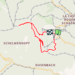

Length
13.3 km

Max alt
977 m

Uphill gradient
573 m
Km-Effort
21 km

Min alt
460 m

Downhill gradient
581 m
Boucle
Yes
Creation date :
2019-01-20 20:50:42.789
Updated on :
2019-01-20 20:50:42.805
4h53
Difficulty : Difficult

FREE GPS app for hiking
 SityTrail
IGN / Geographical institutes
SityTrail Plus
The world is yours!
About
Trail Walking of 13.3 km to be discovered at Grand Est, Haut-Rhin, Thannenkirch. This trail is proposed by LaurentGILG.
Positioning
Country:
France
Region :
Grand Est
Department/Province :
Haut-Rhin
Municipality :
Thannenkirch
Location:
Unknown
Start:(Dec)
Start:(UTM)
374032 ; 5342742 (32U) N.
Comments