


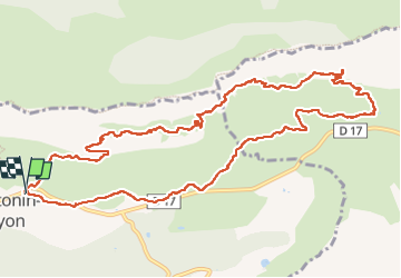
Sainte Victoire Deux Aiguilles Baudino St Ser Deux Aiguilles

rlebasque
User

Length
13.5 km

Max alt
845 m

Uphill gradient
738 m
Km-Effort
23 km

Min alt
409 m

Downhill gradient
738 m
Boucle
Yes
Creation date :
2022-10-20 06:32:14.934
Updated on :
2022-10-20 12:35:46.858
6h02
Difficulty : Very difficult

FREE GPS app for hiking
 SityTrail
IGN / Geographical institutes
SityTrail Plus
The world is yours!
About
Trail Walking of 13.5 km to be discovered at Provence-Alpes-Côte d'Azur, Bouches-du-Rhône, Saint-Antonin-sur-Bayon. This trail is proposed by rlebasque.
Positioning
Country:
France
Region :
Provence-Alpes-Côte d'Azur
Department/Province :
Bouches-du-Rhône
Municipality :
Saint-Antonin-sur-Bayon
Location:
Unknown
Start:(Dec)
Start:(UTM)
709222 ; 4821874 (31T) N.
Comments