Trail Running Bédoin - Perrache - Jas des pellerins - Photo

Perrache - Jas des pellerins

 JPHB
JPHB

User

© OpenStreetMap contributors
Length
Length
16.5 km
Max alt
Max alt
1590 m
Uphill gradient
Uphill gradient
790 m
Km-Effort
Km-Effort  
27 km
Min alt
Min alt
1014 m
Downhill gradient
Downhill gradient
791 m
Boucle
Boucle
No
Creation date :
2014-12-10 00:00:00.0
Updated on :
2014-12-10 00:00:00.0

(0 Reviews)

Running
Running
2h38
Difficulty : Difficult

Scan this QR Code to open this trail in the SityTrail application

FREE GPS app for hiking

Logo SityTrail SityTrail

IGN / Geographical institutes

Download SityTrail from the App Store Download SityTrail from Google Play

Logo SityTrail SityTrail Plus

The world is yours!

Download SityTrail from the App Store Download SityTrail from Google Play Download SityTrail on Huawei AppGallery

About

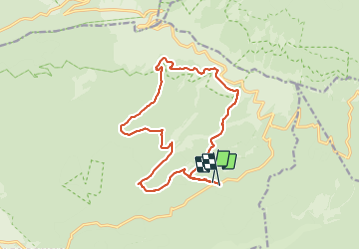
Trail Running of 16.5 km to be discovered at Provence-Alpes-Côte d'Azur, Vaucluse, Bédoin. This trail is proposed by JPHB.

Description

Départ de Perrache ( Parking,
Jas du Roussas, Plaine des Ermitans, descente dans la combe de la grave, Jas de la Fréchière, Jas des Pèlerins, descente de la combe Fiole, Jas de la Couanche, Jas des Compagnons, descente d'une partie de la combe de la Grave, Jas de Serre, Jas du Roussas et retour à Perrache

Elevation profile

Positioning

Country:
France
Region :
Provence-Alpes-Côte d'Azur
Department/Province :
Vaucluse
Municipality :
Bédoin
Location:
Unknown
Start:(UTM)
683811 ; 4889467 (31T) N.


Close
My subscriptions