Trail Walking Chauffour-lès-Étréchy - Chauffour-lès-Etréchy Coteau des Verts Galants - Photo

Chauffour-lès-Etréchy Coteau des Verts Galants

 guydu41
guydu41

User

© OpenStreetMap contributors
Length
Length
4.4 km
Max alt
Max alt
156 m
Uphill gradient
Uphill gradient
96 m
Km-Effort
Km-Effort  
5.7 km
Min alt
Min alt
86 m
Downhill gradient
Downhill gradient
97 m
Boucle
Boucle
Yes
Creation date :
2022-10-21 11:49:50.837
Updated on :
2022-10-22 07:41:26.034

(0 Reviews)

Walking
Walking
1h25
Difficulty : Easy

Scan this QR Code to open this trail in the SityTrail application

FREE GPS app for hiking

Logo SityTrail SityTrail

IGN / Geographical institutes

Download SityTrail from the App Store Download SityTrail from Google Play

Logo SityTrail SityTrail World

The world is yours!

Download SityTrail from the App Store Download SityTrail from Google Play Download SityTrail on Huawei AppGallery

About

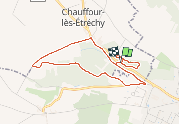
Trail Walking of 4.4 km to be discovered at Ile-de-France, Essonne, Chauffour-lès-Étréchy. This trail is proposed by guydu41.

Description

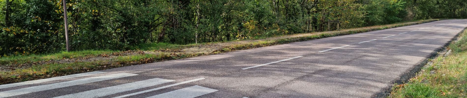
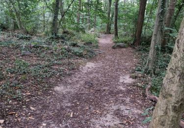
Petite randonnée vers la Butte Boigneuse en empruntant plusieurs passages aménagés avec des escaliers en bois, des chemins et sentiers.
Puis découverte du Coteau des Verts Galants. Ce site aménagé sur les flancs d’un vaste cirque naturel comporte plusieurs niveaux avec des escaliers d'accès et des plates-formes d'observation. Plusieurs panneaux donnent des informations sur les différentes strates observées. Très beau points de vue sur la vallée.
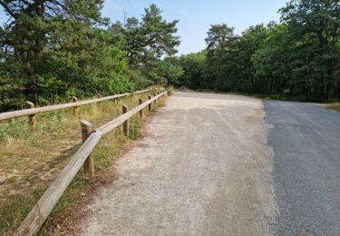
Parking au point de départ le long de la D148.

Elevation profile

Photos

42 photos in total. Please click on a photo to see them all in the gallery.

Positioning

Country:
France
Region :
Ile-de-France
Department/Province :
Essonne
Municipality :
Chauffour-lès-Étréchy
Location:
Unknown
Start:(UTM)
439064 ; 5371967 (31U) N.

Trails nearby

Trail Walking Saint-Sulpice-de-Favières - Les Pétales de Souzy - Photo
Walking
tracegps

Walking

Difficult
(1)
Saint-Sulpice-de-Favières, Ile-de-France, Essonne, France
23 km | 29 km-effort
4h 49min
Yes
Trail On foot Auvers-Saint-Georges - Au grès de la Juine - Photo
On foot
PRO

On foot

Medium
Auvers-Saint-Georges, Ile-de-France, Essonne, France
22 km | 27 km-effort
6h 10min
No
Trail Walking Étréchy - Boucle de 2 jours au départ d'Etréchy via Etampes Chalo St Mars - Photo
Walking
philippebenne

Walking

Very difficult
(1)
Étréchy, Ile-de-France, Essonne, France
42 km | 51 km-effort
11h 28min
Yes
Trail Walking Saint-Sulpice-de-Favières - St Sulpice - Photo
Walking
Auger91

Walking

Medium
(1)
Saint-Sulpice-de-Favières, Ile-de-France, Essonne, France
8 km | 10.1 km-effort
2h 18min
Yes
Trail Walking Villeconin - Villeconin - Photo
Walking
guydu41

Walking

Medium
Villeconin, Ile-de-France, Essonne, France
8.5 km | 10.9 km-effort
2h 11min
Yes
Trail Walking Auvers-Saint-Georges - Auvers-Saint-Georges - Photo
Walking
guydu41

Walking

Medium
Auvers-Saint-Georges, Ile-de-France, Essonne, France
8.3 km | 10.3 km-effort
2h 20min
Yes
Trail Walking Saint-Sulpice-de-Favières - Saint-Sulpice-de-Favières - Photo
Walking
guydu41

Walking

Medium
Saint-Sulpice-de-Favières, Ile-de-France, Essonne, France
7.5 km | 9.4 km-effort
1h 55min
Yes
Trail Walking Chamarande - Lardy - Le Lièvre d'Or - Photo
Walking
guydu41

Walking

Difficult
Chamarande, Ile-de-France, Essonne, France
9 km | 12.4 km-effort
2h 48min
Yes
Trail Walking Étréchy - Forêt Régionale d'Etréchy - Photo
Walking
guydu41

Walking

Medium
Étréchy, Ile-de-France, Essonne, France
7.3 km | 8.8 km-effort
2h 0min
Yes


Close
My subscriptions