Trail Walking Villeconin - Villeconin - Photo
 guydu41
guydu41

User

© OpenStreetMap contributors
Length
Length
8.5 km
Max alt
Max alt
161 m
Uphill gradient
Uphill gradient
180 m
Km-Effort
Km-Effort  
10.9 km
Min alt
Min alt
83 m
Downhill gradient
Downhill gradient
179 m
Boucle
Boucle
Yes
Creation date :
2023-10-20 12:19:25.796
Updated on :
2023-10-25 15:12:51.848

(0 Reviews)

Walking
Walking
2h11
Difficulty : Medium

Scan this QR Code to open this trail in the SityTrail application

FREE GPS app for hiking

Logo SityTrail SityTrail

IGN / Geographical institutes

Download SityTrail from the App Store Download SityTrail from Google Play

Logo SityTrail SityTrail World

The world is yours!

Download SityTrail from the App Store Download SityTrail from Google Play Download SityTrail on Huawei AppGallery

About

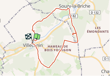
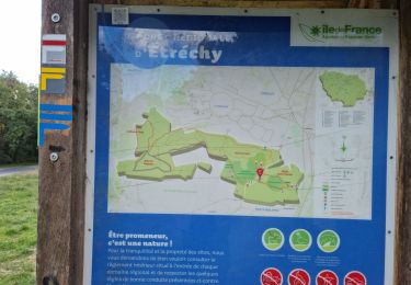
Trail Walking of 8.5 km to be discovered at Ile-de-France, Essonne, Villeconin. This trail is proposed by guydu41.

Description

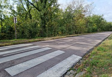
Petit circuit sur des chemins au milieu des champs et sur des sentiers dans plusieurs  bois.
Exploration du Château ruiné de la Grange dans le Bois de même nom.
Traversée de la Vallée de la Renarde avec de beaux points de vue.
Découverte d'un polissoir dans le Bois de la Guigneraie à la base d'un amas rocheux au fond d'une petite vallée. Il n'y a pas de sentier pour y accéder. Il faut suivre la trace GPS proposée.

Elevation profile

Photos

Positioning

Country:
France
Region :
Ile-de-France
Department/Province :
Essonne
Municipality :
Villeconin
Location:
Unknown
Start:(UTM)
435295 ; 5373872 (31U) N.

Trails nearby

Trail Walking Saint-Sulpice-de-Favières - Les Pétales de Souzy - Photo
Walking
tracegps

Walking

Difficult
(1)
Saint-Sulpice-de-Favières, Ile-de-France, Essonne, France
23 km | 29 km-effort
4h 49min
Yes
Trail Walking Saint-Sulpice-de-Favières - St Sulpice - Photo
Walking
Auger91

Walking

Medium
(1)
Saint-Sulpice-de-Favières, Ile-de-France, Essonne, France
8 km | 10.1 km-effort
2h 18min
Yes
Trail Walking Sermaise - 2018-09-26 Rando Sermaise - Photo
Walking
jchezlemas

Walking

Easy
(1)
Sermaise, Ile-de-France, Essonne, France
12.3 km | 15 km-effort
3h 15min
Yes
Trail Walking Saint-Sulpice-de-Favières - Saint-Sulpice-de-Favières - Photo
Walking
guydu41

Walking

Medium
Saint-Sulpice-de-Favières, Ile-de-France, Essonne, France
7.5 km | 9.4 km-effort
1h 55min
Yes
Trail Walking Étréchy - Forêt Régionale d'Etréchy - Photo
Walking
guydu41

Walking

Medium
Étréchy, Ile-de-France, Essonne, France
7.3 km | 8.8 km-effort
2h 0min
Yes
Trail Walking Souzy-la-Briche - Carrières de Madagascar à Souzy-la-Briche  - Photo
Walking
guydu41

Walking

Medium
Souzy-la-Briche, Ile-de-France, Essonne, France
6.8 km | 8.3 km-effort
1h 52min
Yes
Trail Walking Chauffour-lès-Étréchy - Chauffour-lès-Etréchy Coteau des Verts Galants - Photo
Walking
guydu41

Walking

Easy
Chauffour-lès-Étréchy, Ile-de-France, Essonne, France
4.4 km | 5.7 km-effort
1h 25min
Yes
Trail Walking Étréchy - Forêt Régionale d'Etrechy - Photo
Walking
guydu41

Walking

Medium
Étréchy, Ile-de-France, Essonne, France
7.3 km | 9.2 km-effort
2h 34min
Yes
Trail On foot Saint-Sulpice-de-Favières - Randonnée Saint-Sulpice-de-Favieres n°2 - Photo
On foot
Jean Pierre Parent

On foot

Medium
Saint-Sulpice-de-Favières, Ile-de-France, Essonne, France
20 km | 25 km-effort
4h 51min
Yes


Close
My subscriptions