


aubure

duchaine.nicolas
User
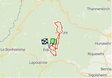

Length
18.9 km

Max alt
966 m

Uphill gradient
711 m
Km-Effort
28 km

Min alt
448 m

Downhill gradient
711 m
Boucle
Yes
Creation date :
2022-10-23 09:15:19.043
Updated on :
2022-10-23 11:20:19.634
2h04
Difficulty : Easy
2h04
Difficulty : Easy

FREE GPS app for hiking
 SityTrail
IGN / Geographical institutes
SityTrail Plus
The world is yours!
About
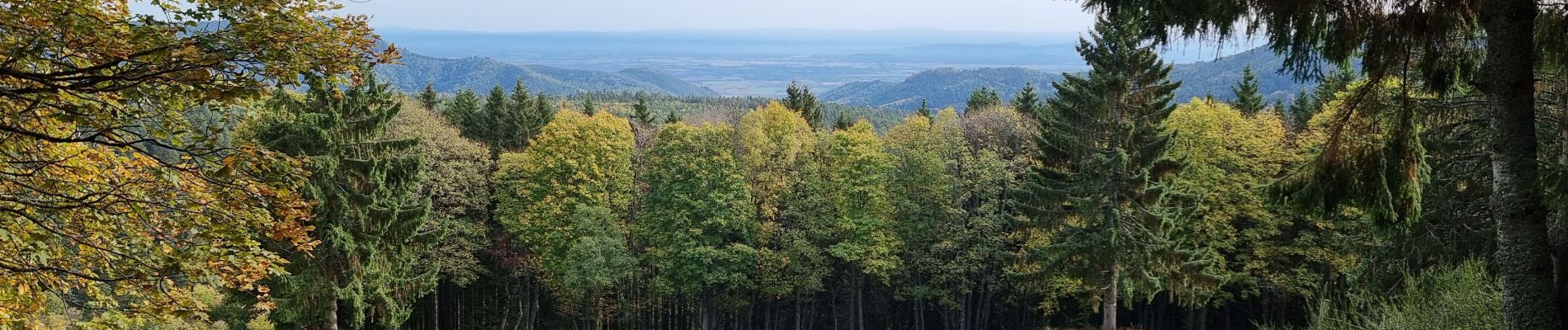
Trail Mountain bike of 18.9 km to be discovered at Grand Est, Haut-Rhin, Fréland. This trail is proposed by duchaine.nicolas.
Photos

Positioning
Country:
France
Region :
Grand Est
Department/Province :
Haut-Rhin
Municipality :
Fréland
Location:
Unknown
Start:(Dec)
Start:(UTM)
365791 ; 5337181 (32U) N.
Comments