


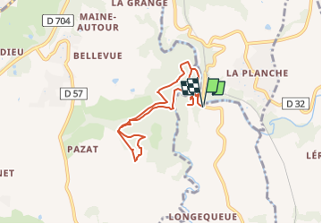

7.5 km | 9.6 km-effort


FREE GPS app for hiking
 SityTrail
IGN / Geographical institutes
SityTrail World
The world is yours!
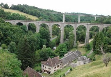
Trail Walking of 7.6 km to be discovered at New Aquitaine, Haute-Vienne, Saint-Jean-Ligoure. This trail is proposed by 001875.84667441c9c14f8380e8aeabd288ca14.1317.
Randonnée Bas du Château de Chalucet et de ses environs.
Walking

Walking
Walking
Walking

Walking

Walking

Equestrian

Mountain bike
Walking