


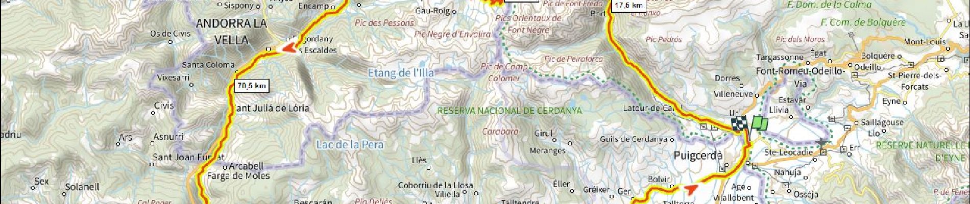
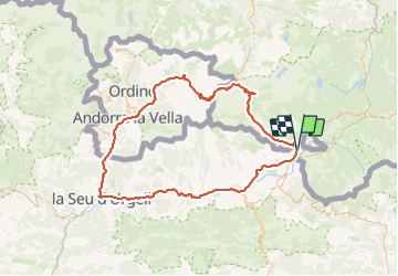
Traversée d'Andorre D+3000m

ericberlin
User

Length
137 km

Max alt
2413 m

Uphill gradient
2965 m
Km-Effort
177 km

Min alt
685 m

Downhill gradient
2966 m
Boucle
Yes
Creation date :
2022-11-08 10:49:00.122
Updated on :
2023-06-05 14:59:41.604
10h42
Difficulty : Very difficult

FREE GPS app for hiking
 SityTrail
IGN / Geographical institutes
SityTrail Plus
The world is yours!
About
Trail Road bike of 137 km to be discovered at Occitania, Pyrénées-Orientales, Ur. This trail is proposed by ericberlin.
Description
Boucle tri-nationale faite plus jeune par le Port d' Envalira 2408m (le plus haut col routier des Pyrennées) et la Seu d'Orgell.
Partis très tôt le matin pour éviter la circulation intense.
Photos

Positioning
Country:
France
Region :
Occitania
Department/Province :
Pyrénées-Orientales
Municipality :
Ur
Location:
Unknown
Start:(Dec)
Start:(UTM)
413327 ; 4699987 (31T) N.
Comments