


hohrodberg

jcschubnel
User
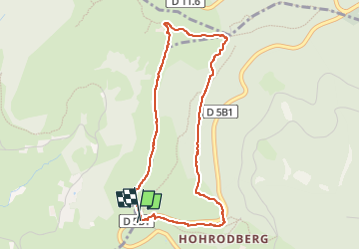

Length
4 km

Max alt
987 m

Uphill gradient
169 m
Km-Effort
6.2 km

Min alt
816 m

Downhill gradient
170 m
Boucle
Yes
Creation date :
2022-10-26 11:26:50.526
Updated on :
2022-11-13 21:10:20.792
2h38
Difficulty : Medium

FREE GPS app for hiking
 SityTrail
IGN / Geographical institutes
SityTrail Plus
The world is yours!
About
Trail Walking of 4 km to be discovered at Grand Est, Haut-Rhin, Hohrod. This trail is proposed by jcschubnel.
Positioning
Country:
France
Region :
Grand Est
Department/Province :
Haut-Rhin
Municipality :
Hohrod
Location:
Unknown
Start:(Dec)
Start:(UTM)
360382 ; 5325451 (32U) N.
Comments