


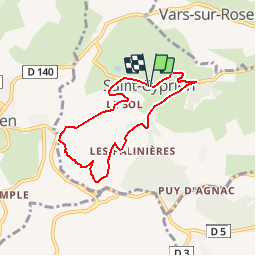
Ruisseaux et côteaux- Saint-Cyprien

houbart
User

Length
6.4 km

Max alt
307 m

Uphill gradient
204 m
Km-Effort
9.1 km

Min alt
146 m

Downhill gradient
201 m
Boucle
Yes
Creation date :
2019-03-28 15:47:36.337
Updated on :
2019-03-28 15:47:36.374
1h59
Difficulty : Easy

FREE GPS app for hiking
 SityTrail
IGN / Geographical institutes
SityTrail Plus
The world is yours!
About
Trail Walking of 6.4 km to be discovered at New Aquitaine, Corrèze, Saint-Cyprien. This trail is proposed by houbart.
Positioning
Country:
France
Region :
New Aquitaine
Department/Province :
Corrèze
Municipality :
Saint-Cyprien
Location:
Unknown
Start:(Dec)
Start:(UTM)
370741 ; 5012092 (31T) N.
Comments
Randonnée facile, principalement sur toute très peu passagère : idéal si terrain trempé. A faire au printemps pour apprécier le sentier botanique.
Une grande partie du circuit est commune avec un sentier botanique. Bon balisage.