


soultzmat. osenburg

Alain28/01
User
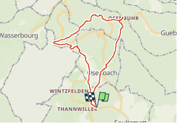

Length
16.3 km

Max alt
769 m

Uphill gradient
527 m
Km-Effort
23 km

Min alt
310 m

Downhill gradient
526 m
Boucle
Yes
Creation date :
2022-12-01 08:24:35.094
Updated on :
2022-12-05 18:52:08.312
3h53
Difficulty : Medium

FREE GPS app for hiking
 SityTrail
IGN / Geographical institutes
SityTrail Plus
The world is yours!
About
Trail Walking of 16.3 km to be discovered at Grand Est, Haut-Rhin, Soultzmatt. This trail is proposed by Alain28/01.
Positioning
Country:
France
Region :
Grand Est
Department/Province :
Haut-Rhin
Municipality :
Soultzmatt
Location:
Unknown
Start:(Dec)
Start:(UTM)
366811 ; 5314383 (32T) N.
Comments