


Champs

ritariri
User
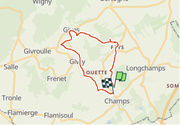

Length
10.9 km

Max alt
475 m

Uphill gradient
225 m
Km-Effort
13.9 km

Min alt
354 m

Downhill gradient
214 m
Boucle
No
Creation date :
2022-12-06 12:48:12.04
Updated on :
2022-12-06 15:31:00.408
2h26
Difficulty : Medium

FREE GPS app for hiking
 SityTrail
IGN / Geographical institutes
SityTrail Plus
The world is yours!
About
Trail Walking of 10.9 km to be discovered at Wallonia, Luxembourg, Bertogne. This trail is proposed by ritariri.
Positioning
Country:
Belgium
Region :
Wallonia
Department/Province :
Luxembourg
Municipality :
Bertogne
Location:
Unknown
Start:(Dec)
Start:(UTM)
690985 ; 5547011 (31U) N.
Comments