


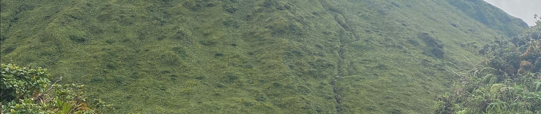
Montagne pelée

Alizée.pee
User GUIDE
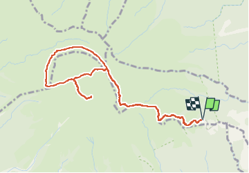

Length
7.5 km

Max alt
1380 m

Uphill gradient
674 m
Km-Effort
16.5 km

Min alt
826 m

Downhill gradient
675 m
Boucle
Yes
Creation date :
2022-12-06 14:01:34.0
Updated on :
2022-12-06 20:36:00.995
6h02
Difficulty : Difficult

FREE GPS app for hiking
 SityTrail
IGN / Geographical institutes
SityTrail Plus
The world is yours!
About
Trail Walking of 7.5 km to be discovered at Martinique, Unknown, L'Ajoupa-Bouillon. This trail is proposed by Alizée.pee.
Description
Départ du refuge de l’Aileron, passage par la Caldeira et le chinois puis retour au refuge.
Photos


Positioning
Country:
France
Region :
Martinique
Department/Province :
Unknown
Municipality :
L'Ajoupa-Bouillon
Location:
Unknown
Start:(Dec)
Start:(UTM)
698937 ; 1637733 (20P) N.
Comments