


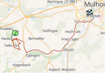
22 12 24 Autour de Gildwiller

jmbilger
User

Length
28 km

Max alt
360 m

Uphill gradient
309 m
Km-Effort
32 km

Min alt
240 m

Downhill gradient
309 m
Boucle
No
Creation date :
2022-12-24 13:59:19.0
Updated on :
2022-12-24 17:32:46.056
2h05
Difficulty : Easy

FREE GPS app for hiking
 SityTrail
IGN / Geographical institutes
SityTrail Plus
The world is yours!
About
Trail Walking of 28 km to be discovered at Grand Est, Haut-Rhin, Gildwiller. This trail is proposed by jmbilger.
Positioning
Country:
France
Region :
Grand Est
Department/Province :
Haut-Rhin
Municipality :
Gildwiller
Location:
Unknown
Start:(Dec)
Start:(UTM)
359841 ; 5283577 (32T) N.
Comments