Trail Walking La Ciotat - la ciotat  boucle St Croix  - Photo
 ego
ego

User

© OpenStreetMap contributors
Length
Length
4.2 km
Max alt
Max alt
333 m
Uphill gradient
Uphill gradient
190 m
Km-Effort
Km-Effort  
6.8 km
Min alt
Min alt
135 m
Downhill gradient
Downhill gradient
191 m
Boucle
Boucle
Yes
Creation date :
2022-12-25 09:53:59.353
Updated on :
2023-01-05 16:04:23.937

(0 Reviews)

Walking
Walking
1h37
Difficulty : Medium

Scan this QR Code to open this trail in the SityTrail application

FREE GPS app for hiking

Logo SityTrail SityTrail

IGN / Geographical institutes

Download SityTrail from the App Store Download SityTrail from Google Play

Logo SityTrail SityTrail World

The world is yours!

Download SityTrail from the App Store Download SityTrail from Google Play Download SityTrail on Huawei AppGallery

About

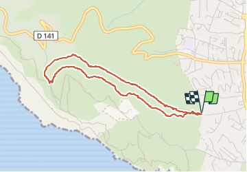
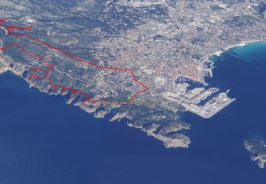
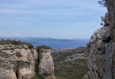
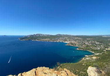
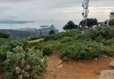
Trail Walking of 4.2 km to be discovered at Provence-Alpes-Côte d'Azur, Bouches-du-Rhône, La Ciotat. This trail is proposed by ego .

Description

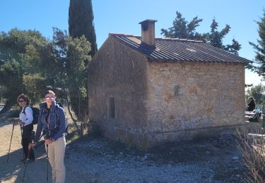
se garer au sommet de l'impasse de ST croix très pentue , on demare en prenant le chemin goudronné a gauche  et on reviendra  par le chemin barré par une chaine de la droite
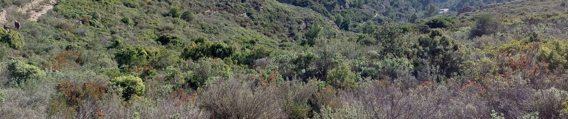
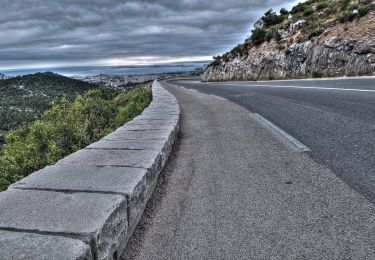
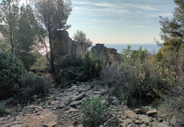
parcours sans difficultés,  très aérien  avec de superbes vues en permanence, on croie de nombreux vestiges de l'ancienne vie rurale dans ce massif qui était entièrement cultivé  !!!!

Elevation profile

Photos

Positioning

Country:
France
Region :
Provence-Alpes-Côte d'Azur
Department/Province :
Bouches-du-Rhône
Municipality :
La Ciotat
Location:
Unknown
Start:(UTM)
710708 ; 4783412 (31T) N.

Trails nearby

Trail Road bike Cassis - 7909608-TRIMRS2017_Parcours Bike L V5 - Photo
Road bike
GUIDE+

Road bike

Medium
(1)
Cassis, Provence-Alpes-Côte d'Azur, Bouches-du-Rhône, France
21 km | 26 km-effort
1h 31min
No
Trail Walking La Ciotat - Rando Ciotat - Photo
Walking
GUIDE
affinetataille

Walking

Difficult
(1)
La Ciotat, Provence-Alpes-Côte d'Azur, Bouches-du-Rhône, France
12.1 km | 19.9 km-effort
7h 30min
Yes
Trail Walking La Ciotat - la ciotat - Photo
Walking
Berrangerannick

Walking

Very easy
(1)
La Ciotat, Provence-Alpes-Côte d'Azur, Bouches-du-Rhône, France
6.2 km | 9.3 km-effort
3h 21min
Yes
Trail Walking Cassis - les calanques de Cassis - Photo
Walking
th.feur

Walking

Medium
(1)
Cassis, Provence-Alpes-Côte d'Azur, Bouches-du-Rhône, France
15.9 km | 23 km-effort
6h 2min
No
Trail Walking La Ciotat - Cap Canaille - Photo
Walking
DanielROLLET

Walking

Medium
(1)
La Ciotat, Provence-Alpes-Côte d'Azur, Bouches-du-Rhône, France
10.2 km | 16.2 km-effort
4h 0min
Yes
Trail Walking La Ciotat - Sémaphore bec de l'Aigle, la Ciotat, 04-10-23  - Photo
Walking
Christiancordin

Walking

Medium
La Ciotat, Provence-Alpes-Côte d'Azur, Bouches-du-Rhône, France
13 km | 19.6 km-effort
3h 53min
Yes
Trail Walking La Ciotat - La Ciotat Cassis par la falaise cap canaille  - Photo
Walking
GUIDE
antignacs

Walking

Easy
La Ciotat, Provence-Alpes-Côte d'Azur, Bouches-du-Rhône, France
7.6 km | 14 km-effort
3h 47min
No
Trail Walking Ceyreste - les cabanons des gardes et du marquis - Photo
Walking
GUIDE
amiral13

Walking

Easy
Ceyreste, Provence-Alpes-Côte d'Azur, Bouches-du-Rhône, France
12 km | 18.1 km-effort
5h 9min
Yes
Trail Walking La Ciotat - la ciotat ND la garde vers le sémaphore par les chemins  - Photo
Walking
ego

Walking

Medium
La Ciotat, Provence-Alpes-Côte d'Azur, Bouches-du-Rhône, France
3.6 km | 7 km-effort
1h 29min
No


Close
My subscriptions