


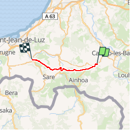
Compostelle espelette - ascain

mhetpierre
User

Length
20 km

Max alt
268 m

Uphill gradient
571 m
Km-Effort
28 km

Min alt
9 m

Downhill gradient
639 m
Boucle
No
Creation date :
2018-08-18 15:31:00.282
Updated on :
2018-08-18 15:31:00.282
6h56
Difficulty : Easy

FREE GPS app for hiking
 SityTrail
IGN / Geographical institutes
SityTrail Plus
The world is yours!
About
Trail Walking of 20 km to be discovered at New Aquitaine, Pyrénées-Atlantiques, Espelette. This trail is proposed by mhetpierre.
Positioning
Country:
France
Region :
New Aquitaine
Department/Province :
Pyrénées-Atlantiques
Municipality :
Espelette
Location:
Unknown
Start:(Dec)
Start:(UTM)
625869 ; 4799720 (30T) N.
Comments