


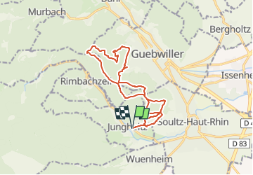
Nez de Soultz Col de Peternit

Alain28/01
User

Length
14.3 km

Max alt
629 m

Uphill gradient
579 m
Km-Effort
22 km

Min alt
314 m

Downhill gradient
579 m
Boucle
Yes
Creation date :
2023-01-04 10:57:22.816
Updated on :
2023-01-04 10:59:29.249
5h00
Difficulty : Very difficult

FREE GPS app for hiking
 SityTrail
IGN / Geographical institutes
SityTrail Plus
The world is yours!
About
Trail Walking of 14.3 km to be discovered at Grand Est, Haut-Rhin, Jungholtz. This trail is proposed by Alain28/01.
Positioning
Country:
France
Region :
Grand Est
Department/Province :
Haut-Rhin
Municipality :
Jungholtz
Location:
Unknown
Start:(Dec)
Start:(UTM)
365367 ; 5305057 (32T) N.
Comments