


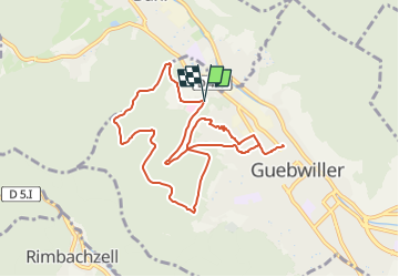
Parking rue de l'Ermite-Hugstein-Luspelkopf-Taverne du vigneron et retour

patrickbeyrath
User

Length
9.3 km

Max alt
489 m

Uphill gradient
331 m
Km-Effort
13.7 km

Min alt
298 m

Downhill gradient
328 m
Boucle
Yes
Creation date :
2023-01-12 09:42:23.353
Updated on :
2023-01-12 10:46:34.843
3h11
Difficulty : Medium

FREE GPS app for hiking
 SityTrail
IGN / Geographical institutes
SityTrail Plus
The world is yours!
About
Trail Walking of 9.3 km to be discovered at Grand Est, Haut-Rhin, Guebwiller. This trail is proposed by patrickbeyrath.
Positioning
Country:
France
Region :
Grand Est
Department/Province :
Haut-Rhin
Municipality :
Guebwiller
Location:
Unknown
Start:(Dec)
Start:(UTM)
365281 ; 5308611 (32T) N.
Comments