


Clos de la Balle

GOHIER
User

Length
4.4 km

Max alt
1682 m

Uphill gradient
324 m
Km-Effort
9.1 km

Min alt
1236 m

Downhill gradient
436 m
Boucle
No
Creation date :
2023-01-19 13:46:49.0
Updated on :
2023-01-19 15:42:26.946
1h54
Difficulty : Unknown

FREE GPS app for hiking
 SityTrail
IGN / Geographical institutes
SityTrail Plus
The world is yours!
About
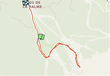
Trail Touring skiing of 4.4 km to be discovered at Auvergne-Rhône-Alpes, Isère, Corrençon-en-Vercors. This trail is proposed by GOHIER.
Description
Seul au monde
Positioning
Country:
France
Region :
Auvergne-Rhône-Alpes
Department/Province :
Isère
Municipality :
Corrençon-en-Vercors
Location:
Unknown
Start:(Dec)
Start:(UTM)
699485 ; 4987439 (31T) N.
Comments