


Tours de Cabrenç

patbt
User

Length
11.9 km

Max alt
1305 m

Uphill gradient
634 m
Km-Effort
20 km

Min alt
682 m

Downhill gradient
627 m
Boucle
Yes
Creation date :
2023-01-07 12:17:20.94
Updated on :
2023-01-22 14:45:56.224
4h58
Difficulty : Easy

FREE GPS app for hiking
 SityTrail
IGN / Geographical institutes
SityTrail Plus
The world is yours!
About
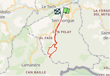
Trail Walking of 11.9 km to be discovered at Occitania, Pyrénées-Orientales, Serralongue. This trail is proposed by patbt.
Positioning
Country:
France
Region :
Occitania
Department/Province :
Pyrénées-Orientales
Municipality :
Serralongue
Location:
Unknown
Start:(Dec)
Start:(UTM)
463378 ; 4694253 (31T) N.
Comments