


Courchevel 1er jour

GOHIER
User
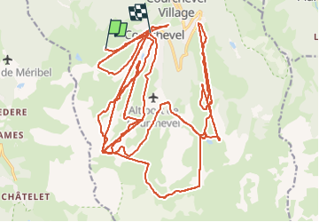

Length
50 km

Max alt
2647 m

Uphill gradient
4721 m
Km-Effort
115 km

Min alt
1586 m

Downhill gradient
5139 m
Boucle
No
Creation date :
2023-01-25 10:43:19.0
Updated on :
2023-01-26 08:30:25.062
5h56
Difficulty : Unknown

FREE GPS app for hiking
 SityTrail
IGN / Geographical institutes
SityTrail Plus
The world is yours!
About
Trail Alpine skiing of 50 km to be discovered at Auvergne-Rhône-Alpes, Savoy, Courchevel. This trail is proposed by GOHIER.
Description
Ski de piste. Froid
Positioning
Country:
France
Region :
Auvergne-Rhône-Alpes
Department/Province :
Savoy
Municipality :
Courchevel
Location:
Saint-Bon-Tarentaise
Start:(Dec)
Start:(UTM)
313464 ; 5031297 (32T) N.
Comments