


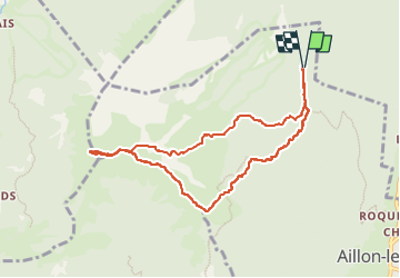
Margeriaz

Chabard
User

Length
8.5 km

Max alt
1852 m

Uphill gradient
501 m
Km-Effort
15.2 km

Min alt
1326 m

Downhill gradient
500 m
Boucle
Yes
Creation date :
2023-01-26 09:04:22.0
Updated on :
2023-01-26 13:01:37.609
3h56
Difficulty : Medium

FREE GPS app for hiking
 SityTrail
IGN / Geographical institutes
SityTrail Plus
The world is yours!
About
Trail Touring skiing of 8.5 km to be discovered at Auvergne-Rhône-Alpes, Savoy, Aillon-le-Jeune. This trail is proposed by Chabard.
Description
Margeriaz
Positioning
Country:
France
Region :
Auvergne-Rhône-Alpes
Department/Province :
Savoy
Municipality :
Aillon-le-Jeune
Location:
Unknown
Start:(Dec)
Start:(UTM)
271399 ; 5058195 (32T) N.
Comments