


Bourbach le haut Sattelboden Rossbreg

Alain28/01
User
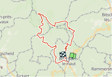

Length
17.2 km

Max alt
1174 m

Uphill gradient
821 m
Km-Effort
28 km

Min alt
557 m

Downhill gradient
810 m
Boucle
Yes
Creation date :
2023-01-27 14:23:50.905
Updated on :
2023-01-27 14:25:42.713
6h23
Difficulty : Very difficult

FREE GPS app for hiking
 SityTrail
IGN / Geographical institutes
SityTrail Plus
The world is yours!
About
Trail Walking of 17.2 km to be discovered at Grand Est, Haut-Rhin, Bourbach-le-Haut. This trail is proposed by Alain28/01.
Positioning
Country:
France
Region :
Grand Est
Department/Province :
Haut-Rhin
Municipality :
Bourbach-le-Haut
Location:
Unknown
Start:(Dec)
Start:(UTM)
352443 ; 5295435 (32T) N.
Comments