Trail Walking Quinson - 2023-01-27 Quinson - Chemin de l'eau et retour rive droite  - Photo

2023-01-27 Quinson - Chemin de l'eau et retour rive droite

 Kargil
Kargil

User GUIDE

© OpenStreetMap contributors
Length
Length
17 km
Max alt
Max alt
518 m
Uphill gradient
Uphill gradient
478 m
Km-Effort
Km-Effort  
23 km
Min alt
Min alt
360 m
Downhill gradient
Downhill gradient
482 m
Boucle
Boucle
Yes
Creation date :
2023-01-27 08:42:34.391
Updated on :
2023-01-27 19:08:53.033

(0 Reviews)

Walking
Walking
4h44
Difficulty : Difficult

Scan this QR Code to open this trail in the SityTrail application

FREE GPS app for hiking

Logo SityTrail SityTrail

IGN / Geographical institutes

Download SityTrail from the App Store Download SityTrail from Google Play

Logo SityTrail SityTrail World

The world is yours!

Download SityTrail from the App Store Download SityTrail from Google Play Download SityTrail on Huawei AppGallery

About

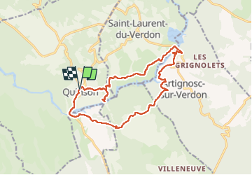
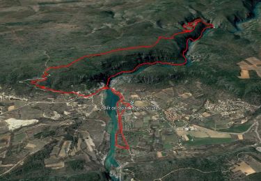
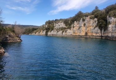
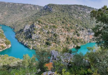
Trail Walking of 17 km to be discovered at Provence-Alpes-Côte d'Azur, Alpes-de-Haute-Provence, Quinson. This trail is proposed by Kargil.

Description

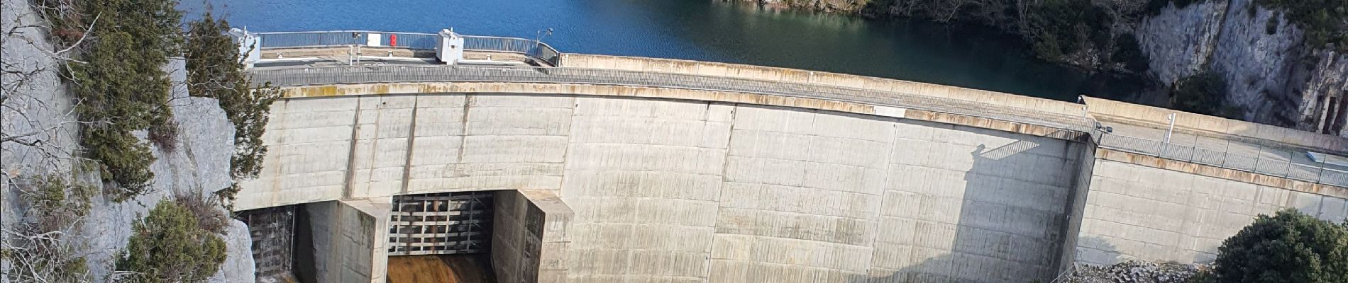
Pas de difficulté technique mais une belle distance et un itinéraire pas très clair après le camping au-dessus du barrage.
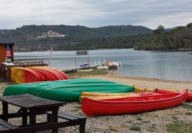
Le sentier qui descend vers le barrage est bloqué après la cabane mais le belvédère est superbe et mérite un petit effort sur un sentier aménagé par des escaliers plus pour la maintenance que pour la randonnée mais c'est jolie,.

Elevation profile

Photos

Points of interest

Point of interest Quinson - Fermeture grillagée - Photo
Kargil
Point of interest Artignosc-sur-Verdon - Belvédère - Photo
Kargil
ARTIGNOSC-SUR-VERDON 

Positioning

Country:
France
Region :
Provence-Alpes-Côte d'Azur
Department/Province :
Alpes-de-Haute-Provence
Municipality :
Quinson
Location:
Unknown
Start:(UTM)
261479 ; 4843111 (32T) N.

Trails nearby

Trail Walking Quinson - basses-gorges-du-verdon-quinson - Photo
Walking
GUIDE
affinetataille

Walking

Medium
(4)
Quinson, Provence-Alpes-Côte d'Azur, Alpes-de-Haute-Provence, France
12.7 km | 16.8 km-effort
2h 54min
Yes
Trail Walking Montagnac-Montpezat - coteau Chiron - Photo
Walking
aubr

Walking

Medium
(1)
Montagnac-Montpezat, Provence-Alpes-Côte d'Azur, Alpes-de-Haute-Provence, France
5.5 km | 6.8 km-effort
1h 37min
Yes
Trail Walking Artignosc-sur-Verdon - 11-10-2022 Artignosc - Baudinard - Photo
Walking
GUIDE
Kargil

Walking

Difficult
Artignosc-sur-Verdon, Provence-Alpes-Côte d'Azur, Var, France
16.9 km | 22 km-effort
3h 42min
Yes
Trail Walking Quinson - 02/10/2022 Quinson - Sentier de la préhistoire - Source de Poiraque - Photo
Walking
GUIDE
Kargil

Walking

Medium
Quinson, Provence-Alpes-Côte d'Azur, Alpes-de-Haute-Provence, France
11.4 km | 15.7 km-effort
3h 11min
Yes
Trail Walking Saint-Laurent-du-Verdon - 02-04-2022 Saint Laurent et son lac - Photo
Walking
GUIDE
Kargil

Walking

Easy
Saint-Laurent-du-Verdon, Provence-Alpes-Côte d'Azur, Alpes-de-Haute-Provence, France
7 km | 8.8 km-effort
2h 9min
Yes
Trail Walking Montmeyan - Verdon Sentier garde canal 05/03/2021 - Photo
Walking
GUIDE
R@ph

Walking

Difficult
Montmeyan, Provence-Alpes-Côte d'Azur, Var, France
9.1 km | 13.9 km-effort
3h 16min
Yes
Trail Walking Quinson - Chapelle Ste maxime, par les basses gorges du Verdon - Photo
Walking
jmheydorff

Walking

Very difficult
(2)
Quinson, Provence-Alpes-Côte d'Azur, Alpes-de-Haute-Provence, France
10.6 km | 15.9 km-effort
3h 48min
Yes
Trail Walking Quinson - Circuit Saint Maxime-basses gorges - Photo
Walking
vacances83

Walking

Difficult
(2)
Quinson, Provence-Alpes-Côte d'Azur, Alpes-de-Haute-Provence, France
9.3 km | 13.6 km-effort
Unknown
No
Trail Mountain bike Quinson - grillon2 - Photo
Mountain bike
johan004

Mountain bike

Difficult
(1)
Quinson, Provence-Alpes-Côte d'Azur, Alpes-de-Haute-Provence, France
19 km | 24 km-effort
Unknown
Yes


Close
My subscriptions