


rodes marcevol lac vinca 547 + 15 km 5h

Erius
User
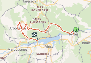

Length
15.1 km

Max alt
587 m

Uphill gradient
547 m
Km-Effort
22 km

Min alt
195 m

Downhill gradient
497 m
Boucle
No
Creation date :
2023-01-18 08:19:20.087
Updated on :
2023-02-11 08:19:43.475
4h21
Difficulty : Very difficult

FREE GPS app for hiking
 SityTrail
IGN / Geographical institutes
SityTrail Plus
The world is yours!
About
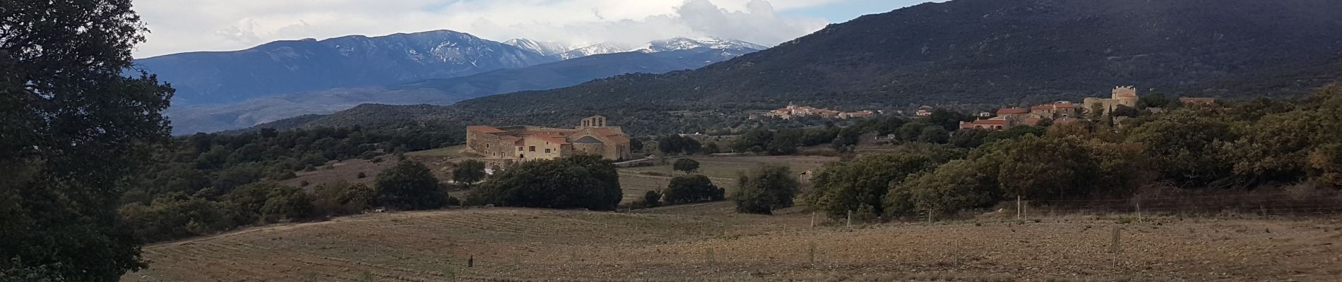
Trail Walking of 15.1 km to be discovered at Occitania, Pyrénées-Orientales, Rodès. This trail is proposed by Erius.
Photos


Positioning
Country:
France
Region :
Occitania
Department/Province :
Pyrénées-Orientales
Municipality :
Rodès
Location:
Unknown
Start:(Dec)
Start:(UTM)
463966 ; 4722768 (31T) N.
Comments