


Col de Clapouse

Clo0413
User

Length
16.3 km

Max alt
1691 m

Uphill gradient
722 m
Km-Effort
26 km

Min alt
1114 m

Downhill gradient
733 m
Boucle
Yes
Creation date :
2023-02-17 17:36:18.505
Updated on :
2023-02-17 17:39:04.886
5h54
Difficulty : Medium

FREE GPS app for hiking
 SityTrail
IGN / Geographical institutes
SityTrail Plus
The world is yours!
About
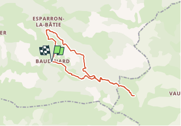
Trail Walking of 16.3 km to be discovered at Provence-Alpes-Côte d'Azur, Alpes-de-Haute-Provence, Bayons. This trail is proposed by Clo0413.
Positioning
Country:
France
Region :
Provence-Alpes-Côte d'Azur
Department/Province :
Alpes-de-Haute-Provence
Municipality :
Bayons
Location:
Esparron-la-Bâtie
Start:(Dec)
Start:(UTM)
272908 ; 4907958 (32T) N.
Comments