![](/images/other/stat-length.png)
![Trail Walking Kelmis - La Calamine - Photo](https://media.geolcdn.com/t/1900/400/ext.pjpeg?maxdim=2&url=https%3A%2F%2Fmedia.geolcdn.com%2Ff%2F606e5792-434a-491a-b5eb-2bfc2ef6f1ed.jpg)
La Calamine
mumu.larandonneuse
User GUIDE
![Length](/images/other/stat-length.png)
Length
9.1 km
![Max alt](https://static1.geolcdn.com/siteimages/upload/files/1508320355ic_sort_altitude_max_24dp.png)
Max alt
288 m
![Uphill gradient](https://static1.geolcdn.com/siteimages/upload/files/1508320355ic_sort_den_pos_24dp.png)
Uphill gradient
189 m
![Km-Effort](/images/other/stat-length.png)
Km-Effort
11.6 km
![Min alt](https://static1.geolcdn.com/siteimages/upload/files/1508320355ic_sort_altitude_min_24dp.png)
Min alt
183 m
![Downhill gradient](https://static1.geolcdn.com/siteimages/upload/files/1508320355ic_sort_den_neg_24dp.png)
Downhill gradient
188 m
![Boucle](https://static1.geolcdn.com/siteimages/upload/files/16400158638029165_repeat_loop_refresh_sync_direction_icon.png)
Boucle
Yes
Creation date :
2023-02-19 18:22:40.061
Updated on :
2023-02-20 14:12:56.445
![Walking](https://static1.geolcdn.com/sitytour/trail-icons/101.png)
2h38
Difficulty : Easy
![Scan this QR Code to open this trail in the SityTrail application](https://capi.geolives.com/qq0zvz2zws4bq2lad0pu/sitytour/trails/3558135/qr.png?size=200)
FREE GPS app for hiking
About
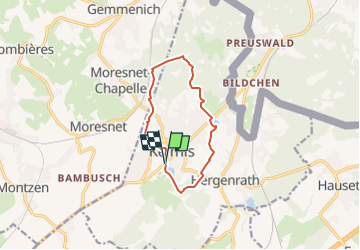
Trail Walking of 9.1 km to be discovered at Wallonia, Liège, Kelmis. This trail is proposed by mumu.larandonneuse.
Description
Une belle boucle campagnarde et forestière autour de La Calamine avant de profiter du défilé des chars carnavalesques du Rosenmontag 🥳.
➡️ Points-noeuds 57 15 99 68 79 86 2 52 59 48 81 74 7 32 45 36 67 38 30 57.
Positioning
Country:
Belgium
Region :
Wallonia
Department/Province :
Liège
Municipality :
Kelmis
Location:
Unknown
Start:(Dec)
Start:(UTM)
288993 ; 5622131 (32U) N.
Comments
Trails nearby
![Trail Walking Kelmis - Le pays calaminaire - Photo](https://media.geolcdn.com/t/375/260/ext.jpg?maxdim=2&url=https%3A%2F%2Fmedia.geolcdn.com%2Ff%2F30655fe2-e81a-47ed-96f4-20092bed94b7.jpg)
![Walking Walking](https://static1.geolcdn.com/sitytour/trail-icons/101.png)
Le pays calaminaire
Walking
Medium
(1)
Kelmis,
Wallonia,
Liège,
Belgium
![](/images/other/stat-length.png)
9.6 km | 12.1 km-effort
2h 44min
![](https://static1.geolcdn.com/siteimages/upload/files/16400158638029165_repeat_loop_refresh_sync_direction_icon.png)
Yes
![Trail Walking Aachen - Aix-la-Chapelle - Photo](https://media.geolcdn.com/t/375/260/ext.jpg?maxdim=2&url=https%3A%2F%2Fmedia.geolcdn.com%2Ff%2F19678e47-68ef-4997-bad3-67eb75fafd82.jpg)
![Walking Walking](https://static1.geolcdn.com/sitytour/trail-icons/101.png)
Aix-la-Chapelle
Walking
Easy
(1)
Aachen,
North Rhine-Westphalia,
Städteregion Aachen,
Germany
![](/images/other/stat-length.png)
11.4 km | 15.4 km-effort
3h 30min
![](https://static1.geolcdn.com/siteimages/upload/files/16400158638029165_repeat_loop_refresh_sync_direction_icon.png)
Yes
![Trail Walking Kelmis - 2022-01-18_14h17m25_kelmis - Photo](https://media.geolcdn.com/t/375/260/ext.jpg?maxdim=2&url=https%3A%2F%2Fmedia.geolcdn.com%2Ff%2F9eea9d75-ea39-4660-b255-7d2a2255555e.jpg)
![Walking Walking](https://static1.geolcdn.com/sitytour/trail-icons/101.png)
2022-01-18_14h17m25_kelmis
Walking
Easy
(1)
Kelmis,
Wallonia,
Liège,
Belgium
![](/images/other/stat-length.png)
14.2 km | 18.4 km-effort
4h 10min
![](https://static1.geolcdn.com/siteimages/upload/files/16400158638029165_repeat_loop_refresh_sync_direction_icon.png)
Yes
![Trail Walking Raeren - 2021-04-02_18h39m41_975 - Photo](https://media.geolcdn.com/t/375/260/ext.jpg?maxdim=2&url=https%3A%2F%2Fmedia.geolcdn.com%2Ff%2F4dbde2fb-33e3-4e75-84b3-1404a45e04cc.jpg)
![Walking Walking](https://static1.geolcdn.com/sitytour/trail-icons/101.png)
2021-04-02_18h39m41_975
Walking
Easy
(1)
Raeren,
Wallonia,
Liège,
Belgium
![](/images/other/stat-length.png)
14.6 km | 17.8 km-effort
4h 2min
![](https://static1.geolcdn.com/siteimages/upload/files/16400158638029165_repeat_loop_refresh_sync_direction_icon.png)
Yes
![Trail Walking Kelmis - 20200730 - Les 3 Bornes 7.3 Km - Photo](https://media.geolcdn.com/t/375/260/ext.jpg?maxdim=2&url=https%3A%2F%2Fmedia.geolcdn.com%2Ff%2Fab7b3f98-4235-4a73-ba70-1bedd5c785f3.jpg)
![Walking Walking](https://static1.geolcdn.com/sitytour/trail-icons/101.png)
20200730 - Les 3 Bornes 7.3 Km
Walking
Difficult
(1)
Kelmis,
Wallonia,
Liège,
Belgium
![](/images/other/stat-length.png)
7.4 km | 10.4 km-effort
1h 50min
![](https://static1.geolcdn.com/siteimages/upload/files/16400158638029165_repeat_loop_refresh_sync_direction_icon.png)
Yes
![Trail Walking Kelmis - Venn Trilogie (1er étape) - Photo](https://media.geolcdn.com/t/375/260/ext.jpg?maxdim=2&url=https%3A%2F%2Fmedia.geolcdn.com%2Ff%2F1309a595-2e15-4d31-9259-ac0f30e3e1c8.jpg)
![Walking Walking](https://static1.geolcdn.com/sitytour/trail-icons/101.png)
Venn Trilogie (1er étape)
Walking
Medium
(1)
Kelmis,
Wallonia,
Liège,
Belgium
![](/images/other/stat-length.png)
25 km | 30 km-effort
5h 0min
![](https://static1.geolcdn.com/siteimages/upload/files/16400158638029165_repeat_loop_refresh_sync_direction_icon.png)
No
![Trail Walking Raeren - RB-Lg-30_Hauset_via-racc-2 - Photo](https://media.geolcdn.com/t/375/260/ext.jpg?maxdim=2&url=https%3A%2F%2Fservices.sitytrail.com%2FGeolivesWS%2FDownloadMedia.ashx%3FTrailID%3D402105%26Media%3Df4d2b2db-afd2-4d70-8342-c9642a40cdea.jpg)
![Walking Walking](https://static1.geolcdn.com/sitytour/trail-icons/101.png)
RB-Lg-30_Hauset_via-racc-2
Walking
(3)
Raeren,
Wallonia,
Liège,
Belgium
![](/images/other/stat-length.png)
13.3 km | 15.9 km-effort
3h 37min
![](https://static1.geolcdn.com/siteimages/upload/files/16400158638029165_repeat_loop_refresh_sync_direction_icon.png)
Yes
![Trail Walking Raeren - RB-Lg-30_Hauset - Photo](https://media.geolcdn.com/t/375/260/ext.jpg?maxdim=2&url=https%3A%2F%2Fservices.sitytrail.com%2FGeolivesWS%2FDownloadMedia.ashx%3FTrailID%3D402103%26Media%3Df4d2b2db-afd2-4d70-8342-c9642a40cdea.jpg)
![Walking Walking](https://static1.geolcdn.com/sitytour/trail-icons/101.png)
![Trail Walking Kelmis - Kelmis - Photo](https://media.geolcdn.com/t/375/260/ext.jpg?maxdim=2&url=https%3A%2F%2Fservices.sitytrail.com%2FGeolivesWS%2FDownloadMedia.ashx%3FTrailID%3D184451%26Media%3D20130412133931.jpg)
![Walking Walking](https://static1.geolcdn.com/sitytour/trail-icons/101.png)
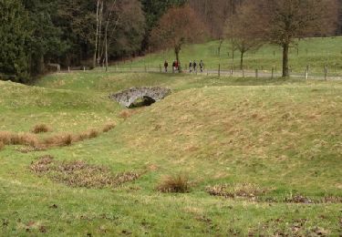
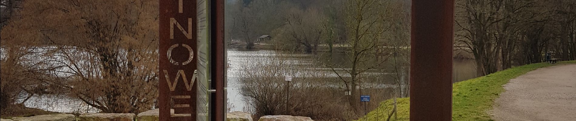
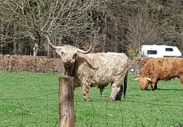
Belle boucle faite avec Luna 🐕