


les aloès. cerbère . coll dells belitres (espagne) . cap cerbère . cerbère. les aloès

stef789
User GUIDE
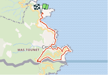

Length
10.6 km

Max alt
177 m

Uphill gradient
390 m
Km-Effort
15.8 km

Min alt
0 m

Downhill gradient
391 m
Boucle
Yes
Creation date :
2023-02-22 10:44:06.364
Updated on :
2023-02-22 15:54:51.702
5h09
Difficulty : Medium

FREE GPS app for hiking
 SityTrail
IGN / Geographical institutes
SityTrail Plus
The world is yours!
About
Trail Walking of 10.6 km to be discovered at Occitania, Pyrénées-Orientales, Cerbère. This trail is proposed by stef789.
Photos
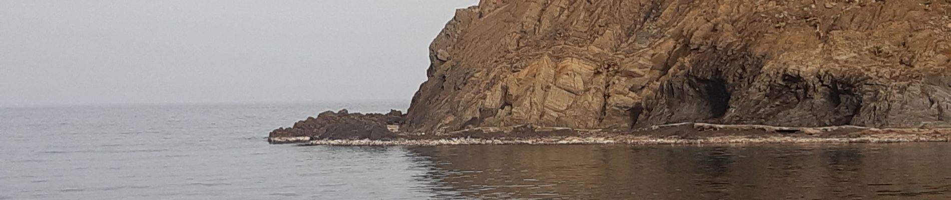
 . cap cerbère . cerbère. les aloès - Photo 1")
 . cap cerbère . cerbère. les aloès - Photo 2")
 . cap cerbère . cerbère. les aloès - Photo 3")
 . cap cerbère . cerbère. les aloès - Photo 4")
 . cap cerbère . cerbère. les aloès - Photo 5")
 . cap cerbère . cerbère. les aloès - Photo 6")
 . cap cerbère . cerbère. les aloès - Photo 7")
 . cap cerbère . cerbère. les aloès - Photo 8")
 . cap cerbère . cerbère. les aloès - Photo 9")
 . cap cerbère . cerbère. les aloès - Photo 10")
 . cap cerbère . cerbère. les aloès - Photo 11")
 . cap cerbère . cerbère. les aloès - Photo 12")
 . cap cerbère . cerbère. les aloès - Photo 13")
 . cap cerbère . cerbère. les aloès - Photo 14")
 . cap cerbère . cerbère. les aloès - Photo 15")
 . cap cerbère . cerbère. les aloès - Photo 16")
 . cap cerbère . cerbère. les aloès - Photo 17")
 . cap cerbère . cerbère. les aloès - Photo 18")
 . cap cerbère . cerbère. les aloès - Photo 19")
 . cap cerbère . cerbère. les aloès - Photo 20")
 . cap cerbère . cerbère. les aloès - Photo 21")
 . cap cerbère . cerbère. les aloès - Photo 22")
 . cap cerbère . cerbère. les aloès - Photo 23")
 . cap cerbère . cerbère. les aloès - Photo 24")
24 photos in total. Please click on a photo to see them all in the gallery.
Positioning
Country:
France
Region :
Occitania
Department/Province :
Pyrénées-Orientales
Municipality :
Cerbère
Location:
Unknown
Start:(Dec)
Start:(UTM)
513146 ; 4700372 (31T) N.
Comments