


chemin direct wildenstein et chateau

janeetlesloups
User
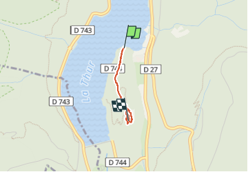

Length
1.2 km

Max alt
658 m

Uphill gradient
108 m
Km-Effort
2.3 km

Min alt
550 m

Downhill gradient
5 m
Boucle
No
Creation date :
2023-02-24 12:03:14.126
Updated on :
2023-02-24 12:40:47.298
36m
Difficulty : Easy

FREE GPS app for hiking
 SityTrail
IGN / Geographical institutes
SityTrail Plus
The world is yours!
About
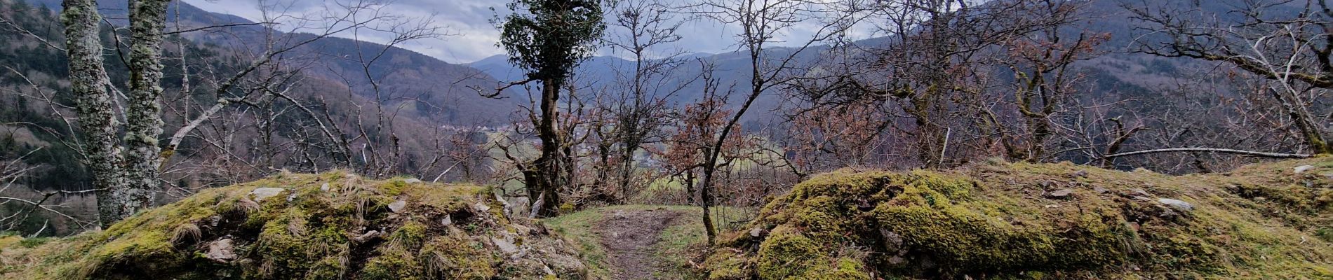
Trail Walking of 1.2 km to be discovered at Grand Est, Haut-Rhin, Kruth. This trail is proposed by janeetlesloups.
Description
sympa
Photos


35 photos in total. Please click on a photo to see them all in the gallery.
Positioning
Country:
France
Region :
Grand Est
Department/Province :
Haut-Rhin
Municipality :
Kruth
Location:
Unknown
Start:(Dec)
Start:(UTM)
347572 ; 5313274 (32T) N.
Comments