


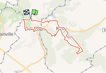

8.7 km | 10.4 km-effort


User


FREE GPS app for hiking
 SityTrail
IGN / Geographical institutes
SityTrail World
The world is yours!
Trail Walking of 8.3 km to be discovered at Hauts-de-France, Oise, Delincourt. This trail is proposed by Marie-Claire-mcp.
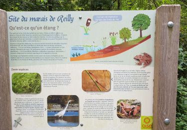
Parking de la mairie à Delincourt - Prendre le chemin à travers prés et au bout tourner à gauche sur la route et prendre le chemin tout droit puis plus loin le chemin à gauche jusqu'à la rue moucheuse, tourner à droite et au bout prendre le petit criket à gauche qui remonte chemin de la messe, prendre à gauche, traverser la place direction cimetière et en face du cimetière prendre le chemin à droite. au bout tourner à gauche jusqu'à la vierge et remonter la route sur 100m et prendre le chemin à gauche qui part sur Reilly, au bout prendre le chemin à droite et faire le tour du marais. puis prendre la route qui traverse le village et à la sortie, prendre le chemin à droite au milieu des chevaux et continuer jusqu'à l'église de Delincourt et rejoindre le parking. - 8.3 km
Walking

Walking

Nordic walking
Walking
Walking
Walking
Walking

Walking

Walking