Trail Walking Froges - Froges-Montfallet-Champ près Froges - Photo

Froges-Montfallet-Champ près Froges

 flip38
flip38

User

© OpenStreetMap contributors
Length
Length
13.5 km
Max alt
Max alt
715 m
Uphill gradient
Uphill gradient
632 m
Km-Effort
Km-Effort  
22 km
Min alt
Min alt
239 m
Downhill gradient
Downhill gradient
632 m
Boucle
Boucle
Yes
Creation date :
2023-02-25 12:15:53.126
Updated on :
2023-02-27 13:41:33.823

(0 Reviews)

Walking
Walking
3h41
Difficulty : Medium

Scan this QR Code to open this trail in the SityTrail application

FREE GPS app for hiking

Logo SityTrail SityTrail

IGN / Geographical institutes

Download SityTrail from the App Store Download SityTrail from Google Play

Logo SityTrail SityTrail World

The world is yours!

Download SityTrail from the App Store Download SityTrail from Google Play Download SityTrail on Huawei AppGallery

About

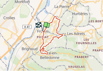
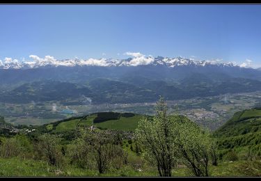
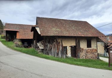
Trail Walking of 13.5 km to be discovered at Auvergne-Rhône-Alpes, Isère, Froges. This trail is proposed by flip38.

Description

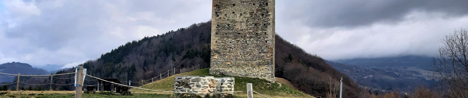
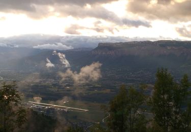
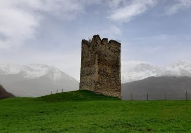
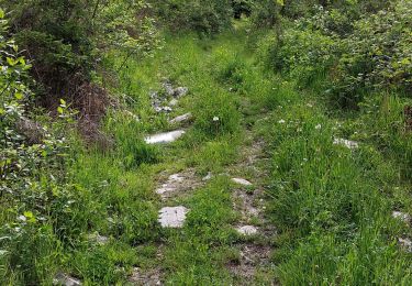
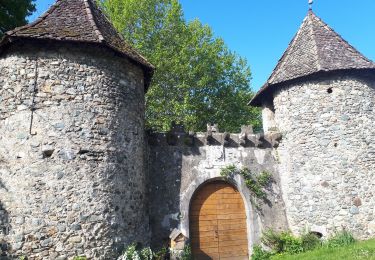
Belle boucle printanière au dessus de Froges et la visite de la tour de Montfallet.
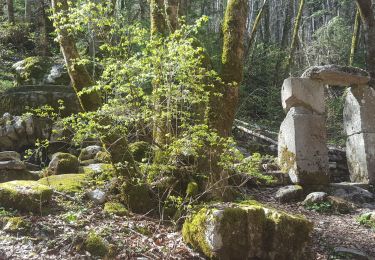
Bon sentiers ou chemins, quelques parties goudronnées sur des routes peu fréquentées.

Elevation profile

Photos

Positioning

Country:
France
Region :
Auvergne-Rhône-Alpes
Department/Province :
Isère
Municipality :
Froges
Location:
Unknown
Start:(UTM)
729398 ; 5017427 (31T) N.

Trails nearby

Trail Walking Plateau-des-Petites-Roches - Piton et Dôme de Bellefont - Photo
Walking
tracegps

Walking

Difficult
(1)
Plateau-des-Petites-Roches, Auvergne-Rhône-Alpes, Isère, France
10.1 km | 24 km-effort
6h 45min
Yes
Trail On foot La Combe-de-Lancey - Chemin de Découverte (boucle Basse) - Photo
On foot
PRO

On foot

Easy
La Combe-de-Lancey, Auvergne-Rhône-Alpes, Isère, France
3.5 km | 5.1 km-effort
1h 9min
Yes
Trail Walking Plateau-des-Petites-Roches - Dent de Crolles tour - Photo
Walking
SylvestreV

Walking

Very easy
(1)
Plateau-des-Petites-Roches, Auvergne-Rhône-Alpes, Isère, France
14.2 km | 32 km-effort
8h 33min
Yes
Trail Walking Laval-en-Belledonne - Boucle Laval - Sainte-Agnès - Photo
Walking
flip38

Walking

Medium
Laval-en-Belledonne, Auvergne-Rhône-Alpes, Isère, France
17.7 km | 29 km-effort
4h 28min
Yes
Trail Walking Theys - TOUR DE LA GRANGE DE BELLE AUX AIRS - Photo
Walking
walrou63

Walking

Medium
Theys, Auvergne-Rhône-Alpes, Isère, France
6.8 km | 10.1 km-effort
1h 40min
Yes
Trail Walking Laval-en-Belledonne - Tour du vallon de Laval - Photo
Walking
Emelle

Walking

Medium
Laval-en-Belledonne, Auvergne-Rhône-Alpes, Isère, France
13.5 km | 21 km-effort
4h 38min
Yes
Trail Walking Plateau-des-Petites-Roches - St Hilaire du Touvet_Moulin de Porte-Traine_Cascade des Dioux - Photo
Walking
ranchoup

Walking

Easy
(1)
Plateau-des-Petites-Roches, Auvergne-Rhône-Alpes, Isère, France
6.9 km | 10.1 km-effort
3h 0min
Yes
Trail Walking Plateau-des-Petites-Roches - La Cabane du Berger de Saint-Hilaire - Photo
Walking
flip38

Walking

Difficult
Plateau-des-Petites-Roches, Auvergne-Rhône-Alpes, Isère, France
16.4 km | 29 km-effort
5h 25min
Yes
Trail Walking La Combe-de-Lancey - Combe de Lancey - la Poya - Photo
Walking
GuyVachet

Walking

Medium
La Combe-de-Lancey, Auvergne-Rhône-Alpes, Isère, France
10.7 km | 16.3 km-effort
5h 48min
Yes


Close
My subscriptions