Trail Walking Villefranche-sur-Cher - Villefranche sur cher  - Photo
 lecmic
lecmic

User

© OpenStreetMap contributors
Length
Length
11.4 km
Max alt
Max alt
137 m
Uphill gradient
Uphill gradient
84 m
Km-Effort
Km-Effort  
12.5 km
Min alt
Min alt
95 m
Downhill gradient
Downhill gradient
81 m
Boucle
Boucle
Yes
Creation date :
2023-03-01 12:49:41.14
Updated on :
2023-03-01 15:52:23.043

(0 Reviews)

Walking
Walking
2h47
Difficulty : Easy

Scan this QR Code to open this trail in the SityTrail application

FREE GPS app for hiking

Logo SityTrail SityTrail

IGN / Geographical institutes

Download SityTrail from the App Store Download SityTrail from Google Play

Logo SityTrail SityTrail World

The world is yours!

Download SityTrail from the App Store Download SityTrail from Google Play Download SityTrail on Huawei AppGallery

About

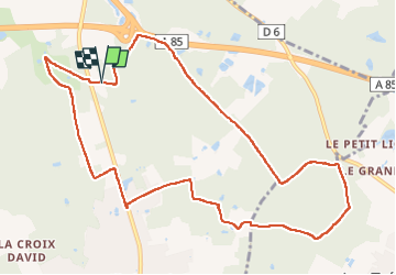
Trail Walking of 11.4 km to be discovered at Centre-Loire Valley, Loir-et-Cher, Villefranche-sur-Cher. This trail is proposed by lecmic.

Description

rando la  bézardiere

Elevation profile

Positioning

Country:
France
Region :
Centre-Loire Valley
Department/Province :
Loir-et-Cher
Municipality :
Villefranche-sur-Cher
Location:
Unknown
Start:(UTM)
406574 ; 5240990 (31T) N.

Trails nearby

Trail Road bike Romorantin-Lanthenay - romo marcilly romo  - Photo
Road bike
mimilolo

Road bike

Very easy
Romorantin-Lanthenay, Centre-Loire Valley, Loir-et-Cher, France
40 km | 44 km-effort
1h 48min
Yes
Trail Walking Villefranche-sur-Cher - Villefranche sur cher  - Photo
Walking
lecmic

Walking

Easy
Villefranche-sur-Cher, Centre-Loire Valley, Loir-et-Cher, France
17.7 km | 19.3 km-effort
2h 54min
Yes
Trail Walking Saint-Julien-sur-Cher - salut Julien sur cher  - Photo
Walking
lecmic

Walking

Easy
Saint-Julien-sur-Cher, Centre-Loire Valley, Loir-et-Cher, France
21 km | 23 km-effort
3h 45min
Yes
Trail Walking Romorantin-Lanthenay - Romo Valençay  - Photo
Walking
lecmic

Walking

Medium
Romorantin-Lanthenay, Centre-Loire Valley, Loir-et-Cher, France
36 km | 40 km-effort
7h 26min
No
Trail Walking Romorantin-Lanthenay - romorantin - Photo
Walking
lecmic

Walking

Easy
Romorantin-Lanthenay, Centre-Loire Valley, Loir-et-Cher, France
11 km | 12.1 km-effort
1h 46min
Yes
Trail Walking Langon-sur-Cher - les etrils langon - Photo
Walking
lecmic

Walking

Very easy
Langon-sur-Cher, Centre-Loire Valley, Loir-et-Cher, France
14.3 km | 15.4 km-effort
2h 58min
Yes
Trail Walking Gièvres - pruniers - Photo
Walking
lecmic

Walking

Easy
Gièvres, Centre-Loire Valley, Loir-et-Cher, France
7.5 km | 8.2 km-effort
2h 4min
Yes
Trail Walking Romorantin-Lanthenay - romorantin chabris - Photo
Walking
lecmic

Walking

Very easy
Romorantin-Lanthenay, Centre-Loire Valley, Loir-et-Cher, France
19 km | 20 km-effort
4h 9min
No
Trail Walking Saint-Julien-sur-Cher - Saint Julien sur cher - Photo
Walking
lecmic

Walking

Medium
Saint-Julien-sur-Cher, Centre-Loire Valley, Loir-et-Cher, France
10.5 km | 11.6 km-effort
2h 19min
Yes


Close
My subscriptions