Trail Walking Unknown - visite Caceres retour au camping  - Photo

visite Caceres retour au camping

 taguette
taguette

User

© OpenStreetMap contributors
Length
Length
12.6 km
Max alt
Max alt
492 m
Uphill gradient
Uphill gradient
237 m
Km-Effort
Km-Effort  
15.9 km
Min alt
Min alt
401 m
Downhill gradient
Downhill gradient
271 m
Boucle
Boucle
No
Creation date :
2023-03-02 09:16:32.99
Updated on :
2023-03-02 14:51:23.359

(0 Reviews)

Walking
Walking
5h30
Difficulty : Easy

Scan this QR Code to open this trail in the SityTrail application

FREE GPS app for hiking

Logo SityTrail SityTrail

IGN / Geographical institutes

Download SityTrail from the App Store Download SityTrail from Google Play

Logo SityTrail SityTrail World

The world is yours!

Download SityTrail from the App Store Download SityTrail from Google Play Download SityTrail on Huawei AppGallery

About

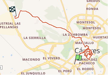
Trail Walking of 12.6 km to be discovered at Extremadura, Cáceres. This trail is proposed by taguette.

Description

Départ du camping en Bus ligne 5 qui vous dépose dans le centre le retour est possible à pied 6km, par un petit chemin sympa.

Elevation profile

Positioning

Country:
Spain
Region :
Extremadura
Department/Province :
Cáceres
Municipality :
Unknown
Location:
Unknown
Start:(UTM)
725476 ; 4372037 (29S) N.

Trails nearby

Trail Walking  - casares à casar de casares - Photo
Walking
suzanne.bron

Walking

Difficult
, Extremadura, Cáceres, Spain
12.2 km | 14.7 km-effort
3h 2min
No


Close
My subscriptions