Trail Walking Ratières - Ratières  - Photo
 meillon
meillon

User

© OpenStreetMap contributors
Length
Length
7.2 km
Max alt
Max alt
445 m
Uphill gradient
Uphill gradient
243 m
Km-Effort
Km-Effort  
10.4 km
Min alt
Min alt
267 m
Downhill gradient
Downhill gradient
242 m
Boucle
Boucle
Yes
Creation date :
2023-03-04 13:40:42.239
Updated on :
2023-03-04 16:26:41.513

(0 Reviews)

Walking
Walking
2h34
Difficulty : Easy

Scan this QR Code to open this trail in the SityTrail application

FREE GPS app for hiking

Logo SityTrail SityTrail

IGN / Geographical institutes

Download SityTrail from the App Store Download SityTrail from Google Play

Logo SityTrail SityTrail World

The world is yours!

Download SityTrail from the App Store Download SityTrail from Google Play Download SityTrail on Huawei AppGallery

About

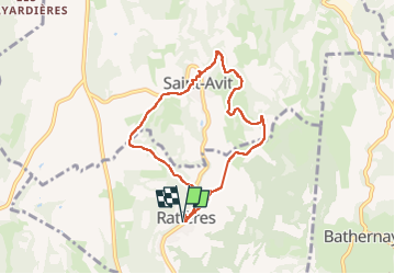
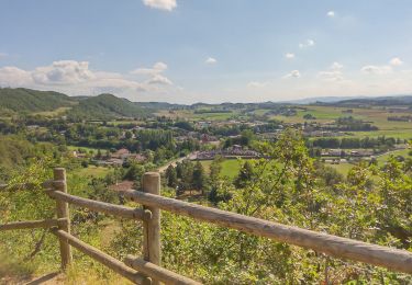
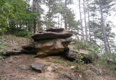
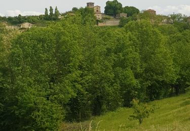
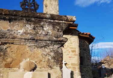
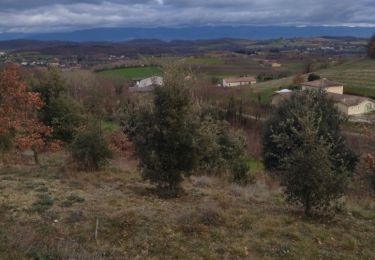
Trail Walking of 7.2 km to be discovered at Auvergne-Rhône-Alpes, Drôme, Ratières. This trail is proposed by meillon.

Description

passage par Saint Avit puis par la combe Broudelaire. Évitez la propriété privée autour de la tour de Ratières.

Elevation profile

Positioning

Country:
France
Region :
Auvergne-Rhône-Alpes
Department/Province :
Drôme
Municipality :
Ratières
Location:
Unknown
Start:(UTM)
654543 ; 5004975 (31T) N.

Trails nearby

Trail Walking Claveyson - Le bois de Suze - Photo
Walking
crocau

Walking

Very easy
(1)
Claveyson, Auvergne-Rhône-Alpes, Drôme, France
3.6 km | 5.3 km-effort
1h 9min
Yes
Trail Walking Bren - 26 bren 29 04 2021 - Photo
Walking
himba26100

Walking

Easy
Bren, Auvergne-Rhône-Alpes, Drôme, France
17.4 km | 24 km-effort
6h 1min
No
Trail Walking Saint-Donat-sur-l'Herbasse - lac de champos bois de sizay - Photo
Walking
Gilbertbancilhon

Walking

Very easy
(1)
Saint-Donat-sur-l'Herbasse, Auvergne-Rhône-Alpes, Drôme, France
11.2 km | 14.6 km-effort
3h 1min
Yes
Trail Walking Saint-Donat-sur-l'Herbasse - le bois de Sizay - Photo
Walking
bob2023

Walking

Very easy
Saint-Donat-sur-l'Herbasse, Auvergne-Rhône-Alpes, Drôme, France
6.1 km | 8.6 km-effort
1h 52min
Yes
Trail Walking Claveyson - Prieure de Saint Andeol - Photo
Walking
meillon

Walking

Medium
Claveyson, Auvergne-Rhône-Alpes, Drôme, France
8.3 km | 11.9 km-effort
2h 47min
Yes
Trail Walking Montchenu - 26 chapelle st Roche montchenu - Photo
Walking
himba26100

Walking

Easy
Montchenu, Auvergne-Rhône-Alpes, Drôme, France
12.6 km | 17.3 km-effort
3h 18min
No
Trail Walking Saint-Donat-sur-l'Herbasse - 26 st donar pas a pas - Photo
Walking
himba26100

Walking

Very easy
Saint-Donat-sur-l'Herbasse, Auvergne-Rhône-Alpes, Drôme, France
10.6 km | 15.7 km-effort
3h 24min
No
Trail Walking La Motte-de-Galaure - La Motte sur Galaure - Photo
Walking
meillon

Walking

Medium
La Motte-de-Galaure, Auvergne-Rhône-Alpes, Drôme, France
7 km | 8.7 km-effort
2h 52min
Yes
Trail Walking Ratières - Ratieres - Photo
Walking
lesCC

Walking

Easy
Ratières, Auvergne-Rhône-Alpes, Drôme, France
17.9 km | 24 km-effort
6h 7min
No


Close
My subscriptions