


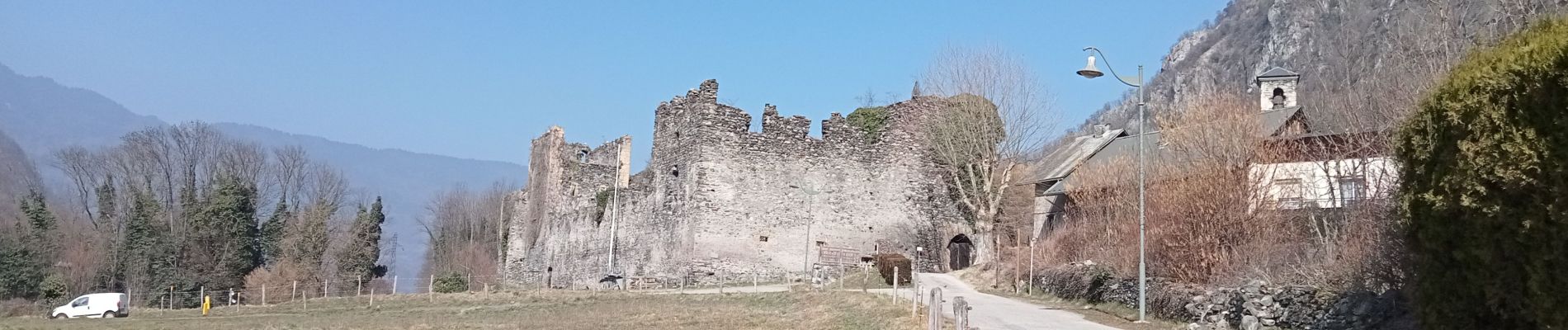
Epierre

laurentnecca
User
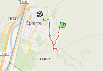

Length
1.9 km

Max alt
522 m

Uphill gradient
56 m
Km-Effort
2.9 km

Min alt
392 m

Downhill gradient
130 m
Boucle
No
Creation date :
2023-03-05 10:26:48.251
Updated on :
2023-03-05 11:16:06.48
49m
Difficulty : Easy

FREE GPS app for hiking
 SityTrail
IGN / Geographical institutes
SityTrail Plus
The world is yours!
About
Trail Walking of 1.9 km to be discovered at Auvergne-Rhône-Alpes, Savoy, Épierre. This trail is proposed by laurentnecca.
Photos


Positioning
Country:
France
Region :
Auvergne-Rhône-Alpes
Department/Province :
Savoy
Municipality :
Épierre
Location:
Unknown
Start:(Dec)
Start:(UTM)
289037 ; 5036717 (32T) N.
Comments