


Port vendredi Anciennes fortifications

FAUCET
User
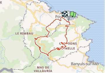

Length
18.5 km

Max alt
638 m

Uphill gradient
822 m
Km-Effort
29 km

Min alt
0 m

Downhill gradient
821 m
Boucle
Yes
Creation date :
2023-03-08 08:00:46.078
Updated on :
2023-03-08 08:00:48.578
6h41
Difficulty : Very difficult

FREE GPS app for hiking
 SityTrail
IGN / Geographical institutes
SityTrail Plus
The world is yours!
About
Trail Walking of 18.5 km to be discovered at Occitania, Pyrénées-Orientales, Port-Vendres. This trail is proposed by FAUCET.
Description
PORT VENDRES
Positioning
Country:
France
Region :
Occitania
Department/Province :
Pyrénées-Orientales
Municipality :
Port-Vendres
Location:
Unknown
Start:(Dec)
Start:(UTM)
508893 ; 4707158 (31T) N.
Comments