


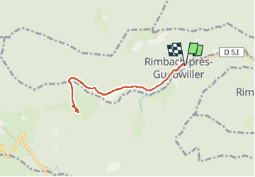
23 03 12 Autour de Rimbach Guebwiller

jmbilger
User

Length
6.7 km

Max alt
829 m

Uphill gradient
299 m
Km-Effort
10.7 km

Min alt
558 m

Downhill gradient
300 m
Boucle
Yes
Creation date :
2023-03-12 10:37:54.0
Updated on :
2023-03-12 14:19:07.397
1h57
Difficulty : Unknown

FREE GPS app for hiking
 SityTrail
IGN / Geographical institutes
SityTrail Plus
The world is yours!
About
Trail Walking of 6.7 km to be discovered at Grand Est, Haut-Rhin, Rimbach-près-Guebwiller. This trail is proposed by jmbilger.
Positioning
Country:
France
Region :
Grand Est
Department/Province :
Haut-Rhin
Municipality :
Rimbach-près-Guebwiller
Location:
Unknown
Start:(Dec)
Start:(UTM)
362284 ; 5307354 (32T) N.
Comments