


190323 Boucle voie Sarde

mzonzon05
User
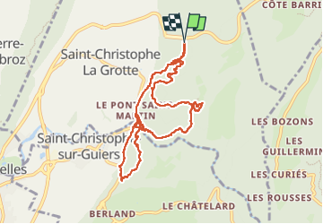

Length
9.7 km

Max alt
599 m

Uphill gradient
437 m
Km-Effort
15.6 km

Min alt
418 m

Downhill gradient
434 m
Boucle
Yes
Creation date :
2023-03-19 11:11:56.932
Updated on :
2023-03-19 15:28:01.59
3h50
Difficulty : Difficult

FREE GPS app for hiking
 SityTrail
IGN / Geographical institutes
SityTrail Plus
The world is yours!
About
Trail Walking of 9.7 km to be discovered at Auvergne-Rhône-Alpes, Savoy, Saint-Christophe. This trail is proposed by mzonzon05.
Description
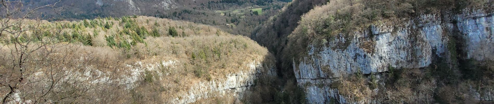
Jolie boucle au frais le long du Guirrs Vif parfois, alternant bon sentiers forestiers et sentiers de chèvres 🐐.
Certainement un bon terrain de jeu pour ceux qui aiment le trail
Photos


Positioning
Country:
France
Region :
Auvergne-Rhône-Alpes
Department/Province :
Savoy
Municipality :
Saint-Christophe
Location:
Unknown
Start:(Dec)
Start:(UTM)
718290 ; 5037058 (31T) N.
Comments